
Fil:Ghurids1200.png
Størrelse af denne forhåndsvisning: 800 × 467 pixels. Andre opløsninger: 320 × 187 pixels | 640 × 373 pixels | 1.024 × 597 pixels | 1.644 × 959 pixels.
Fuld opløsning (1.644 × 959 billedpunkter, filstørrelse: 28 KB, MIME-type: image/png)
|
|
Denne fil er fra Wikimedia Commons. Beskrivelsen af filen fra Commons er gengivet nedenfor. |
Beskrivelse
| Beskrivelse |
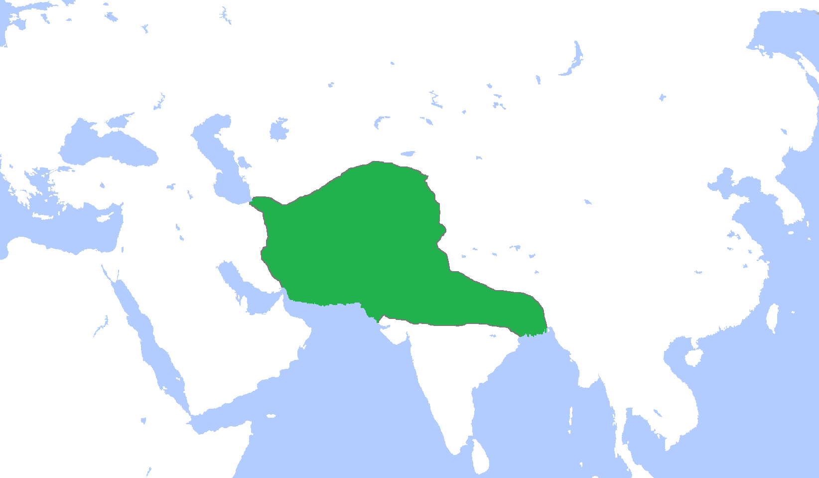
English: Locator map of the Ghurid Empire, c. 1200.
(Partially based on Atlas of World History (2007) - The World 1000-1200, map) |
| Dato | |
| Kilde | Eget arbejde |
| Forfatter | Gabagool |
Licensering
Jeg, dette værks ophavsretsindehaver, publicerer hermed værket under den følgende licens:
Denne fil er licenseret under Creative Commons Navngivelse 3.0 Unported-licensen.
- Du må frit:
- at dele – at kopiere, distribuere og overføre værket
- at remixe – at tilpasse værket
- Under følgende vilkår:
- kreditering – Du skal give passende kreditering, angive et link til licensen, og oplyse om der er foretaget ændringer. Du må gøre det på enhver fornuftig måde, men ikke på en måde der antyder at licensgiveren godkender dig eller din anvendelse.
Filhistorik
Klik på en dato/tid for at se filen som den så ud på det tidspunkt.
| Dato/tid | Miniaturebillede | Dimensioner | Bruger | Kommentar | |
|---|---|---|---|---|---|
| nuværende | 9. jan. 2014, 18:06 | | 1.644 × 959 (28 KB) | HistoryofIran | Added the domains of the Bamiyan branch. |
| 29. dec. 2013, 17:35 |  | 1.644 × 959 (28 KB) | HistoryofIran | Fixed. | |
| 29. dec. 2013, 14:00 |  | 1.644 × 959 (28 KB) | HistoryofIran | Made the map more accurate. | |
| 18. jun. 2013, 14:57 |  | 1.644 × 959 (28 KB) | HistoryofIran | ||
| 24. apr. 2009, 17:32 |  | 1.644 × 959 (53 KB) | Gabagool | {{Information |Description={{en|1=Locator map of the Ghurid Empire, c. 1200. (Partially based on ''Atlas of World History'' (2007) - The World 1000-1200, map)}} |Source=Own work by uploader |Author=Gabagool / Jarle Grøhn |Date=2009-04- |
Filanvendelse
Den følgende side bruger denne fil:
Global filanvendelse
Følgende andre wikier anvender denne fil:
- Anvendelser på ar.wikipedia.org
- الدولة الغزنوية
- غوريون
- نيسابور
- غزنة
- باميان
- ولاية غور
- محمد الغوري
- قالب:غوريون
- مستخدم:محمد رشاد ابوالنجا/Spread of Islam
- أبو علي بن محمد
- محمد بن سوري
- أمير سوري
- عباس بن شيت
- محمد بن عباس
- قطب الدين حسن
- عز الدين حسين
- سيف الدين سوري
- بهاء الدين سام الأول
- علاء الدين حسين
- غياث الدين محمد
- بهاء الدين سام الثالث
- غياث الدين محمود
- Anvendelser på arz.wikipedia.org
- Anvendelser på av.wikipedia.org
- Anvendelser på azb.wikipedia.org
- Anvendelser på az.wikipedia.org
- Anvendelser på ba.wikipedia.org
- Anvendelser på bn.wikipedia.org
- Anvendelser på ca.wikipedia.org
- Anvendelser på ceb.wikipedia.org
- Anvendelser på cv.wikipedia.org
- Anvendelser på de.wikipedia.org
- Anvendelser på en.wikipedia.org
Vis flere globale anvendelser af denne fil.