
Fil:Map of Nevada NA.png
Størrelse af denne forhåndsvisning: 776 × 600 pixels. Andre opløsninger: 311 × 240 pixels | 621 × 480 pixels | 994 × 768 pixels | 1.280 × 989 pixels | 2.122 × 1.640 pixels.
Fuld opløsning (2.122 × 1.640 billedpunkter, filstørrelse: 1,5 MB, MIME-type: image/png)
|
|
Denne fil er fra Wikimedia Commons. Beskrivelsen af filen fra Commons er gengivet nedenfor. |
Beskrivelse
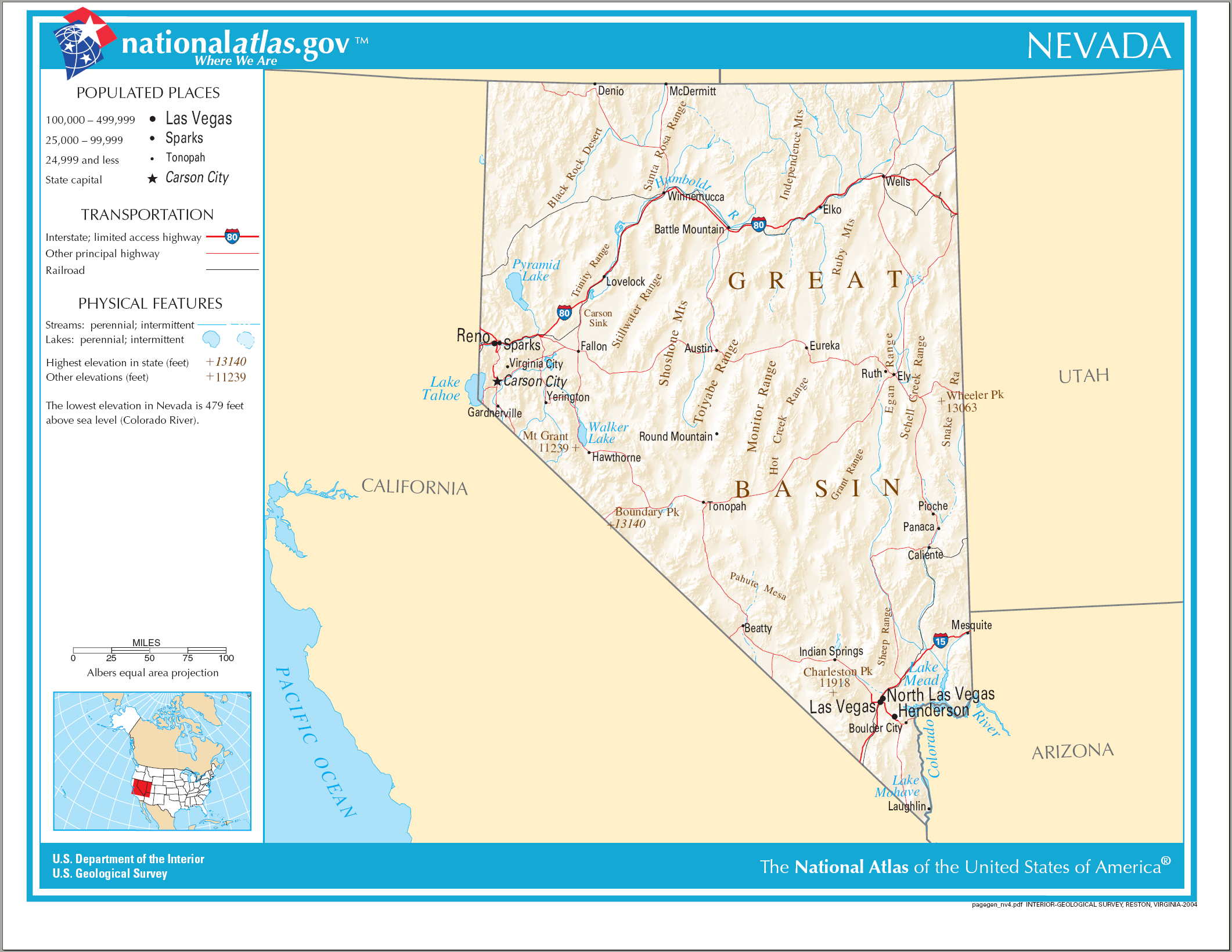
| Beskrivelse | Map of Nevada |
| Dato | |
| Kilde | National Atlas |
| Forfatter | Huebi~commonswiki |
Licensering
This map was obtained from an edition of the National Atlas of the United States. Like almost all works of the U.S. federal government, works from the National Atlas are in the public domain in the United States.
Online access: NationalAtlas.gov | 1970 print edition: Library of Congress, Perry-Castañeda Library
|
Filhistorik
Klik på en dato/tid for at se filen som den så ud på det tidspunkt.
| Dato/tid | Miniaturebillede | Dimensioner | Bruger | Kommentar | |
|---|---|---|---|---|---|
| nuværende | 14. aug. 2006, 23:27 | | 2.122 × 1.640 (1,5 MB) | Huebi~commonswiki | {{Information| |Description=Map of Nevada |Source=[http://www.nationalatlas.gov National Atlas] }} Category:Maps of the United States Category:Maps of Nevada {{PD-USGov-Atlas}} |
Filanvendelse
Den følgende side bruger denne fil:
Global filanvendelse
Følgende andre wikier anvender denne fil:
- Anvendelser på als.wikipedia.org
- Anvendelser på de.wikipedia.org
- Anvendelser på en.wikipedia.org
- Anvendelser på es.wikipedia.org
- Anvendelser på fr.wikipedia.org
- Anvendelser på hr.wiktionary.org
- Anvendelser på hsb.wikipedia.org
- Anvendelser på hu.wikipedia.org
- Anvendelser på incubator.wikimedia.org
- Anvendelser på it.wikipedia.org
- Anvendelser på lt.wikipedia.org
- Anvendelser på sw.wikipedia.org
- Anvendelser på szl.wikipedia.org
- Anvendelser på zea.wikipedia.org