
Fil:PEFO park map 2006 large.png
Størrelse af denne forhåndsvisning: 485 × 600 pixels. Andre opløsninger: 194 × 240 pixels | 388 × 480 pixels | 621 × 768 pixels | 828 × 1.024 pixels | 1.800 × 2.225 pixels.
Fuld opløsning (1.800 × 2.225 billedpunkter, filstørrelse: 1,69 MB, MIME-type: image/png)
|
|
Denne fil er fra Wikimedia Commons. Beskrivelsen af filen fra Commons er gengivet nedenfor. |
Beskrivelse
| Beskrivelse |
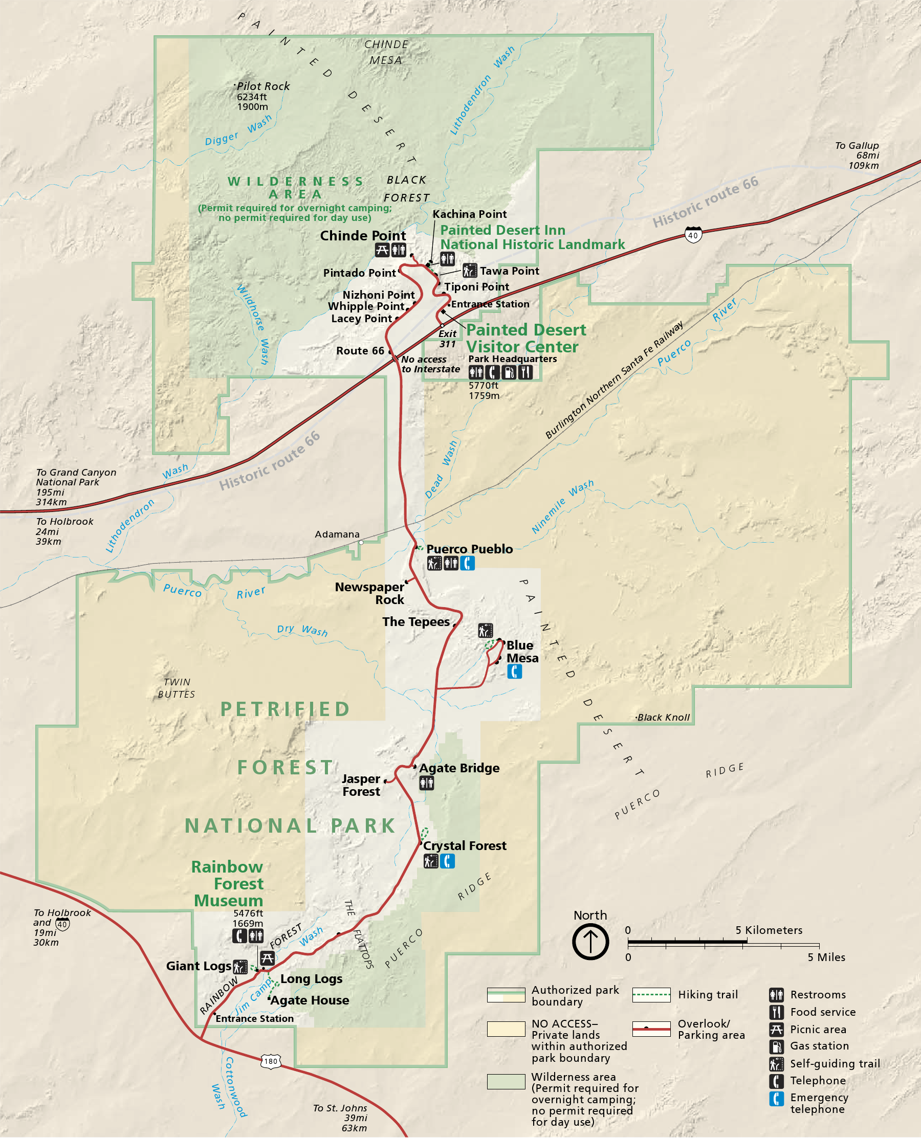
English: Map of Petrified Forest National Park — in northeastern Arizona, United States.
|
| Dato | |
| Kilde | official park map |
| Forfatter | National Park Service; converted from PDF to PNG format by User:Finetooth using GNU Image Manipulation Program (GIMP) software |
Licensering
| This image or media file contains material based on a work of a National Park Service employee, created as part of that person's official duties. As a work of the U.S. federal government, such work is in the public domain in the United States. See the NPS website and NPS copyright policy for more information. |
Filhistorik
Klik på en dato/tid for at se filen som den så ud på det tidspunkt.
| Dato/tid | Miniaturebillede | Dimensioner | Bruger | Kommentar | |
|---|---|---|---|---|---|
| nuværende | 28. okt. 2010, 22:41 | | 1.800 × 2.225 (1,69 MB) | Finetooth | {{Information |Description={{en|1=Map of Petrified Forest National Park in northeastern Arizona, United States}} |Source=National Park Service [http://www.nps.gov/pefo/planyourvisit/maps.htm maps] |Au |
Filanvendelse
Den følgende side bruger denne fil:
Global filanvendelse
Følgende andre wikier anvender denne fil:
- Anvendelser på de.wikipedia.org
- Anvendelser på en.wikipedia.org
- Anvendelser på eu.wikipedia.org
- Anvendelser på he.wikipedia.org
- Anvendelser på nl.wikipedia.org
- Anvendelser på pl.wikipedia.org
- Anvendelser på pt.wikipedia.org
- Anvendelser på tr.wikipedia.org
- Anvendelser på vi.wikipedia.org