
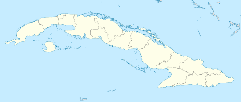
Fil:Cuba location map.svg

Size of this PNG preview of this SVG file: 800 × 339 pixels. Andre opløsninger: 320 × 136 pixels | 640 × 271 pixels | 1.024 × 434 pixels | 1.280 × 543 pixels | 2.560 × 1.085 pixels | 1.795 × 761 pixels.
Fuld opløsning (SVG fil, basisstørrelse 1.795 × 761 pixels, filstørrelse: 310 KB)
|
|
Denne fil er fra Wikimedia Commons. Beskrivelsen af filen fra Commons er gengivet nedenfor. |
Beskrivelse
| Beskrivelse |
Deutsch: Positionskarte von Kuba
Quadratische Plattkarte, N-S-Streckung 105 %. Geographische Begrenzung der Karte:
English: Location map of Cuba
Equirectangular projection, N/S stretching 105 %. Geographic limits of the map:
|
||
| Dato | |||
| Kilde | Eget arbejde, using United States National Imagery and Mapping Agency data | ||
| Forfatter | NordNordWest | ||
| SVG udvikling | Vektorgrafikken blev lavet med unknown tool.
|

Licensering
Jeg, dette værks ophavsretsindehaver, udgiver hermed værket under den følgende licens:

|
Tilladelse er givet til at kopiere, distribuere og/eller ændre dette dokument under betingelserne i GNU Free Documentation License', Version 1.2 eller enhver senere version udgivet af Free Software Foundation; uden et invariant afsnit, ingen forsidetekster, og ingen bagsidetekst. En kopi af licensen er inkluderet i afsnittet GNU Free Documentation License. |
Denne fil er udgivet under Creative Commons Kreditering-Del på samme vilkår 3.0 Ikke-porteret-licensen.
- Du må frit:
- at dele – at kopiere, distribuere og overføre værket
- at remixe – at tilpasse værket
- Under følgende vilkår:
- kreditering – Du skal give passende kreditering, angive et link til licensen, og oplyse om der er foretaget ændringer. Du må gøre det på enhver fornuftig måde, men ikke på en måde der antyder at licensgiveren godkender dig eller din anvendelse.
- deling på samme vilkår – Hvis du bearbejder, ændrer eller bygger videre på dette værk, skal du distribuere dine bidrag under den samme eller en kompatibel licens som originalen.
Du kan vælge den licens du foretrækker.
Filhistorik
Klik på en dato/tid for at se filen som den så ud på det tidspunkt.
| Dato/tid | Miniaturebillede | Dimensioner | Bruger | Kommentar | |
|---|---|---|---|---|---|
| nuværende | 31. dec. 2010, 13:47 | | 1.795 × 761 (310 KB) | NordNordWest | upd |
| 4. sep. 2008, 21:33 |  | 1.796 × 761 (458 KB) | NordNordWest | minor corrections at contents and graphics | |
| 3. sep. 2008, 22:37 |  | 1.796 × 761 (461 KB) | NordNordWest | {{Information |Description= {{de|Positionskarte von Kuba}} Quadratische Plattkarte, N-S-Streckung 105 %. Geographische Begrenzung der Karte: * N: 23.8° N * S: 19.2° N * W: 85.2° W * O: 73.8° W {{en|Location map of Cuba}} Equi |
Filanvendelse
De følgende 10 sider bruger denne fil:
Global filanvendelse
Følgende andre wikier anvender denne fil:
- Anvendelser på af.wikipedia.org
- Anvendelser på an.wikipedia.org
- Anvendelser på ar.wikipedia.org
- Anvendelser på ast.wikipedia.org
- L'Habana
- Estadiu Calixto García Íñiguez
- Santiago de Cuba
- Capitoliu de L'Habana
- Palaciu de la Revolución
- Plaza de la Revolución
- Módulu:Mapa de llocalización/datos/Cuba
- Aeropuertu Baracoa
- Aeropuertu Gustavo Rizo
- Aeropuertu Hermanos Ameijeiras
- Aeropuertu Juan Gualberto Gómez
- Aeropuertu Rafael Cabrera
- Aeropuertu de Cayo Coco
- Boca de Camarioca
- Matanzas
- Módulu:Mapa de llocalización/datos/Cuba/usu
- Santa Clara (Cuba)
- Anvendelser på az.wikipedia.org
- Anvendelser på ban.wikipedia.org
- Anvendelser på ba.wikipedia.org
- Anvendelser på be-tarask.wikipedia.org
Vis flere globale anvendelser af denne fil.