
Fil:GreenlandSeaPolarProjectionTopo.jpg
Der findes ingen højere opløsning af billedet
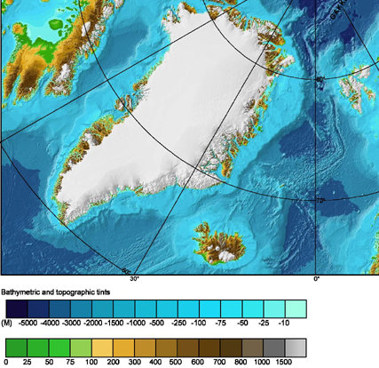
GreenlandSeaPolarProjectionTopo.jpg (427 × 414 billedpunkter, filstørrelse: 72 KB, MIME-type: image/jpeg)
|
|
Denne fil er fra Wikimedia Commons. Beskrivelsen af filen fra Commons er gengivet nedenfor. |
| Beskrivelse | |
| Dato | (UTC) |
| Kilde | |
| Forfatter |
|
This image is in the public domain because it contains materials that originally came from the U.S. National Oceanic and Atmospheric Administration, taken or made as part of an employee's official duties.
|
Oprindelig oplægningslog
This image is a derivative work of the following images:
- File:IBCAO_betamap.jpg licensed with PD-USGov-NOAA
- 2007-08-02T00:29:14Z Mikkalai 762x868 (726688 Bytes) Source: http://www.ngdc.noaa.gov/mgg/image/IBCAO_betamap.jpg Bathymetric map of the [[w:Arctic Ocean]]
Uploaded with derivativeFX
Filhistorik
Klik på en dato/tid for at se filen som den så ud på det tidspunkt.
| Dato/tid | Miniaturebillede | Dimensioner | Bruger | Kommentar | |
|---|---|---|---|---|---|
| nuværende | 6. sep. 2010, 01:50 | | 427 × 414 (72 KB) | Materialscientist | {{Information |Description= |Source=*File:IBCAO_betamap.jpg |Date=2010-09-05 23:49 (UTC) |Author=*File:IBCAO_betamap.jpg: noaa.gov *derivative work: ~~~ |Permission= |other_versions= }} {{self|PD-USGov-NOAA}} == {{Original upload log}} == Th |
Filanvendelse
Den følgende side bruger denne fil:
Global filanvendelse
Følgende andre wikier anvender denne fil:
- Anvendelser på ar.wikipedia.org
- Anvendelser på bn.wikipedia.org
- Anvendelser på ca.wikipedia.org
- Anvendelser på en.wikipedia.org
- Anvendelser på eo.wikipedia.org
- Anvendelser på es.wikipedia.org
- Anvendelser på hr.wikipedia.org
- Anvendelser på is.wikipedia.org
- Anvendelser på it.wikipedia.org
- Anvendelser på la.wikipedia.org
- Anvendelser på nl.wikipedia.org
- Anvendelser på sv.wikipedia.org
- Anvendelser på uk.wikipedia.org
- Anvendelser på ur.wikipedia.org
- Anvendelser på vi.wikipedia.org
- Anvendelser på www.wikidata.org