
Fil:Honey Hill.jpg
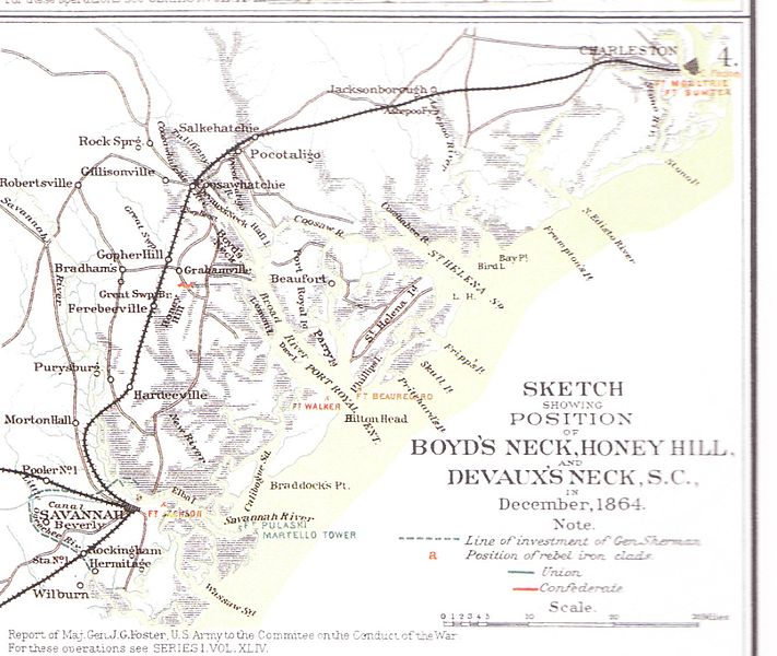
Størrelse af denne forhåndsvisning: 711 × 600 pixels. Andre opløsninger: 285 × 240 pixels | 569 × 480 pixels | 910 × 768 pixels | 1.214 × 1.024 pixels | 1.338 × 1.129 pixels.
Fuld opløsning (1.338 × 1.129 billedpunkter, filstørrelse: 299 KB, MIME-type: image/jpeg)
|
|
Denne fil er fra Wikimedia Commons. Beskrivelsen af filen fra Commons er gengivet nedenfor. |
Beskrivelse
| Beskrivelse |
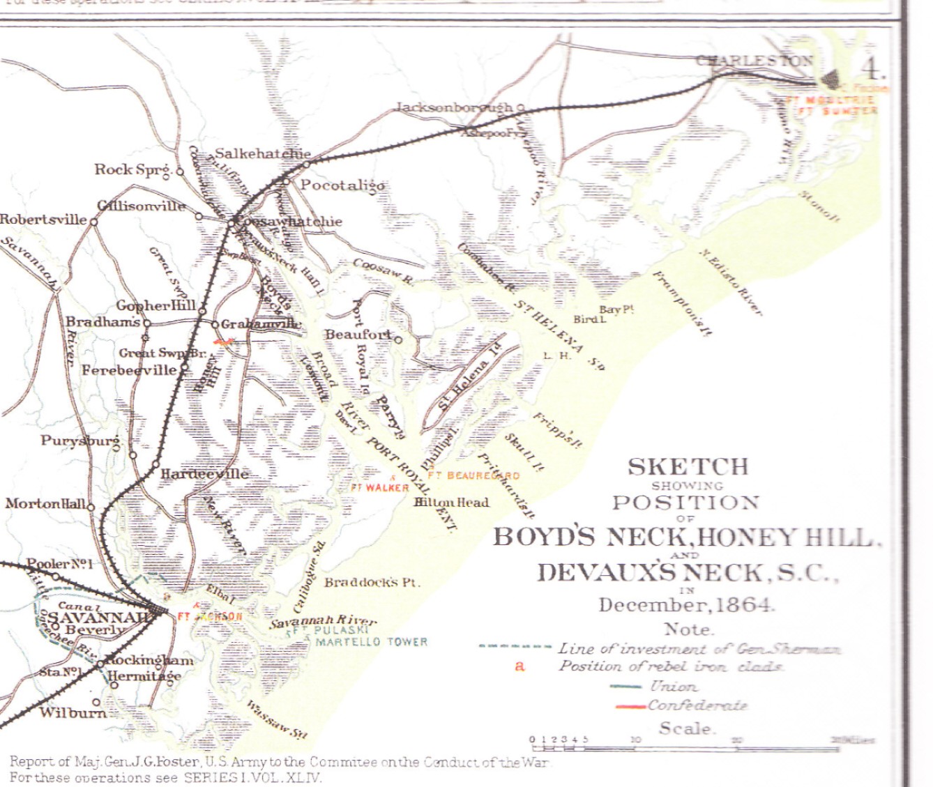
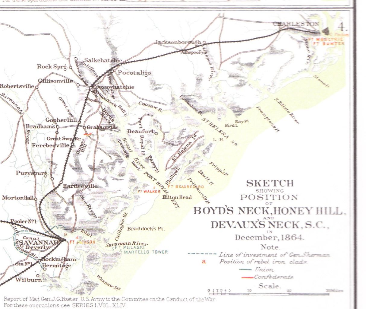
English: Sketch of the region where the Battle of Honey Hill took place |
| Kilde | Military Atlas of the Civil War, Plate XCI, No. 3 |
| Forfatter | Made for the report of Maj.Gen. John G. Foster, US Army, to the Commitee on the Conduct of the War |
Licensering
This file is a work of a U.S. Army soldier or employee, taken or made as part of that person's official duties. As a work of the U.S. federal government, it is in the public domain in the United States.
|
 |
Filhistorik
Klik på en dato/tid for at se filen som den så ud på det tidspunkt.
| Dato/tid | Miniaturebillede | Dimensioner | Bruger | Kommentar | |
|---|---|---|---|---|---|
| nuværende | 30. jul. 2010, 11:25 | | 1.338 × 1.129 (299 KB) | WBTS-Forum.de | (uploaded wrong image) |
| 30. jul. 2010, 11:23 |  | 2.480 × 3.507 (1,35 MB) | WBTS-Forum.de | {{Information |Description={{en|1=Sketch of the region where the Battle of Honey Hill took place}} |Source=Military Atlas of the Civil War, Plate XCI, No. 3 |Author=Made for the report of Maj.Gen. John G. Foster, US Army, to the Commitee on the Conduct of |
Filanvendelse
Den følgende side bruger denne fil:
Global filanvendelse
Følgende andre wikier anvender denne fil:
- Anvendelser på de.wikipedia.org
- Anvendelser på en.wikipedia.org
- Anvendelser på en.wikivoyage.org
- Anvendelser på es.wikipedia.org
- Anvendelser på nl.wikipedia.org
- Anvendelser på www.wikidata.org