
Fil:Map of USA HI full.png
Der findes ingen højere opløsning af billedet
Map_of_USA_HI_full.png (286 × 186 billedpunkter, filstørrelse: 21 KB, MIME-type: image/png)
|
|
Denne fil er fra Wikimedia Commons. Beskrivelsen af filen fra Commons er gengivet nedenfor. |
Beskrivelse

|
En vektorversion af dette billede (SVG) er tilgængelig. Det bør bruges i stedet for punktgrafikbilledet når det er fordelagtigt.
File:Map of USA HI full.png → File:Map of USA HI full.svg
For mere information om vektorgrafik: Læs om overgangen til SVG på Commons. Se også information om MediaWikis understøttelse af SVG-billeder. |
 |
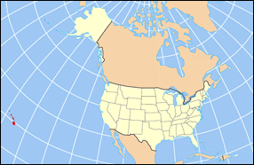
| Beskrivelse | Map of USA with Hawaii highlighted and shown in true position |
| Kilde | http://www.nationalatlas.gov/printable/reference.html |
| Forfatter |
Licensering
This map was obtained from an edition of the National Atlas of the United States. Like almost all works of the U.S. federal government, works from the National Atlas are in the public domain in the United States.
Online access: NationalAtlas.gov | 1970 print edition: Library of Congress, Perry-Castañeda Library
|
Filhistorik
Klik på en dato/tid for at se filen som den så ud på det tidspunkt.
| Dato/tid | Miniaturebillede | Dimensioner | Bruger | Kommentar | |
|---|---|---|---|---|---|
| nuværende | 2. apr. 2007, 18:30 | | 286 × 186 (21 KB) | MattWright | fix to more standard map colors |
| 1. apr. 2007, 21:09 |  | 286 × 186 (19 KB) | MattWright | {{Information |Description=Map of USA with Hawaii highlighted and shown in true position |Source=http://www.nationalatlas.gov/printable/reference.html |Date= |Author= |Permission= |other_versions= }} Category:Maps of the United States [[Category:Maps |
Filanvendelse
De følgende 4 sider bruger denne fil:
Global filanvendelse
Følgende andre wikier anvender denne fil:
- Anvendelser på bcl.wikipedia.org
- Anvendelser på bo.wikipedia.org
- Anvendelser på en.wikipedia.org
- Anvendelser på es.wikipedia.org
- Anvendelser på fa.wikipedia.org
- Anvendelser på hu.wikipedia.org
- Anvendelser på id.wikipedia.org
- Anvendelser på ja.wikipedia.org
- Anvendelser på ko.wikipedia.org
- Anvendelser på mrj.wikipedia.org
- Anvendelser på mr.wikipedia.org
- Anvendelser på pl.wikipedia.org
- Anvendelser på pl.wikinews.org
- Anvendelser på pl.wiktionary.org
- Anvendelser på ro.wikipedia.org
- Anvendelser på sv.wikipedia.org
- Anvendelser på uk.wikipedia.org
- Anvendelser på vi.wikipedia.org