
Fil:USACE Webbers Falls Lock and Dam.jpg
Størrelse af denne forhåndsvisning: 400 × 599 pixels. Andre opløsninger: 160 × 240 pixels | 320 × 480 pixels | 1.001 × 1.500 pixels.
Fuld opløsning (1.001 × 1.500 billedpunkter, filstørrelse: 580 KB, MIME-type: image/jpeg)
|
|
Denne fil er fra Wikimedia Commons. Beskrivelsen af filen fra Commons er gengivet nedenfor. |
| Beskrivelse |
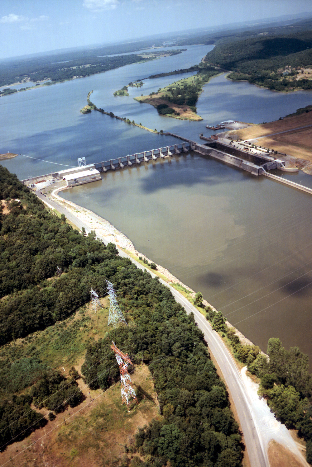
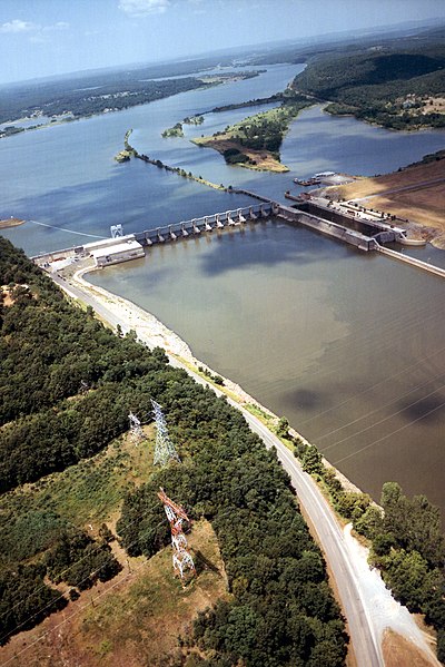
English: Aerial view of Webbers Falls Lock and Dam on the Arkansas River in Muskogee County, Oklahoma, USA. The dam is located about 4 miles (6.4 km) upriver from the town of Webbers Falls and about 62 miles (100 km) (straight line) southeast of Tulsa. The U.S. Army Corps of Engineers maintains the locks and the river channel for barge navigation on the river. View is upriver to the northwest.
Coordinates: 35°33′13.73″N 95°10′9.26″W / 35.5538139°N 95.1692389°W |
|||
| Placering | Muskogee County, Oklahoma, USA | |||
| Dato | (Caveat: Dates provided by U.S. Army Corps of Engineers Digital Visual Library are not reliable and may be wrong.) | |||
| Kilde |
U.S. Army Corps of Engineers Digital Visual Library Image page Image description page Digital Visual Library home page |
|||
| Forfatter | U.S. Army Corps of Engineers, photographer not specified or unknown | |||
| Tilladelse (Genbrug af denne fil) |
|
Filhistorik
Klik på en dato/tid for at se filen som den så ud på det tidspunkt.
| Dato/tid | Miniaturebillede | Dimensioner | Bruger | Kommentar | |
|---|---|---|---|---|---|
| nuværende | 11. maj 2007, 05:15 | | 1.001 × 1.500 (580 KB) | DanMS | {{Information | Description = {{en|Aerial view of Webbers Falls Lock and Dam on the Arkansas River in Muskogee County, Oklahoma, USA. The dam is located about 4 miles (6.4 km) upriver from the town of Webbers Falls and about 62 miles (100 km) (straight |
Filanvendelse
Den følgende side bruger denne fil:
Global filanvendelse
Følgende andre wikier anvender denne fil:
- Anvendelser på en.wikipedia.org
- Anvendelser på es.wikipedia.org
- Anvendelser på fr.wikipedia.org
- Anvendelser på ja.wikipedia.org
- Anvendelser på ky.wikipedia.org
- Anvendelser på pt.wikipedia.org
- Anvendelser på www.wikidata.org
- Anvendelser på zh.wikipedia.org