
Fil:Chad relief map 1991, CIA.jpg

Størrelse af denne forhåndsvisning: 503 × 599 pixels. Andre opløsninger: 201 × 240 pixels | 403 × 480 pixels | 645 × 768 pixels | 1.036 × 1.234 pixels.
Fuld opløsning (1.036 × 1.234 billedpunkter, filstørrelse: 196 KB, MIME-type: image/jpeg)
|
|
Denne fil er fra Wikimedia Commons. Beskrivelsen af filen fra Commons er gengivet nedenfor. |
Beskrivelse
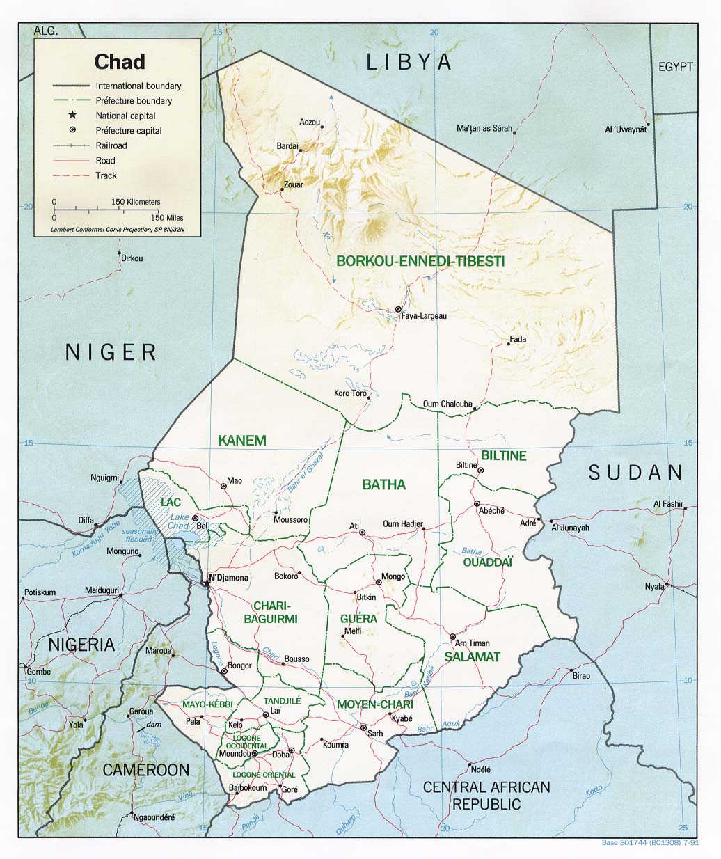
| Beskrivelse | Shaded relief map of Chad, 1991, produced by the U.S. Central Intelligence Agency. |
| Dato | |
| Kilde | University of Texas Libraries, Perry-Castañeda Library Map Collection: Chad Maps |
| Forfatter | CIA |
Licensering
| This image is a work of a Central Intelligence Agency employee, taken or made as part of that person's official duties. As a Work of the United States Government, this image or media is in the public domain in the United States.
|

|
Filhistorik
Klik på en dato/tid for at se filen som den så ud på det tidspunkt.
| Dato/tid | Miniaturebillede | Dimensioner | Bruger | Kommentar | |
|---|---|---|---|---|---|
| nuværende | 21. feb. 2006, 13:58 | | 1.036 × 1.234 (196 KB) | Lupo | Shaded relief map of Chad. Source: [http://www.lib.utexas.edu/maps/africa/chad_rel91.jpg] from the [http://www.lib.utexas.edu/maps/chad.html Perry-Castañeda Library Map Collection]. {{PD-USGov-CIA}} Category:Maps of Chad |
Filanvendelse
De følgende 3 sider bruger denne fil:
Global filanvendelse
Følgende andre wikier anvender denne fil:
- Anvendelser på ast.wikipedia.org
- Anvendelser på azb.wikipedia.org
- Anvendelser på az.wikipedia.org
- Anvendelser på be.wikipedia.org
- Anvendelser på bg.wikipedia.org
- Anvendelser på ca.wikipedia.org
- Anvendelser på cs.wikipedia.org
- Anvendelser på cv.wikipedia.org
- Anvendelser på de.wikipedia.org
- Anvendelser på en.wikipedia.org
- Anvendelser på es.wikipedia.org
- Anvendelser på fr.wikipedia.org
- Anvendelser på hr.wiktionary.org
- Anvendelser på id.wikipedia.org
- Anvendelser på it.wikipedia.org
- Anvendelser på ja.wikipedia.org
- Anvendelser på lt.wikipedia.org
- Anvendelser på mt.wikipedia.org
- Anvendelser på no.wikipedia.org
- Anvendelser på os.wikipedia.org
- Anvendelser på pl.wikipedia.org
- Anvendelser på ru.wikipedia.org
- Anvendelser på sv.wikipedia.org
- Anvendelser på uk.wikipedia.org
- Користувач:Alex Blokha/Події в Вікіпедії/20 червня
- Користувач:Alex Blokha/Події в Вікіпедії/25 червня
- Користувач:Alex Blokha/Події в Вікіпедії/26 червня
- Користувач:Alex Blokha/Події в Вікіпедії/27 червня
- Користувач:Alex Blokha/Події в Вікіпедії/4 липня
- Користувач:Alex Blokha/Події в Вікіпедії/19 липня
- Користувач:Alex Blokha/Події в Вікіпедії/24 липня
- Користувач:Alex Blokha/Події в Вікіпедії/10 серпня
- Користувач:Alex Blokha/Події в Вікіпедії/12 серпня
- Користувач:Alex Blokha/Події в Вікіпедії/20 серпня
- Користувач:Alex Blokha/Події в Вікіпедії/17 вересня
- Користувач:Alex Blokha/Події в Вікіпедії/25 вересня
- Користувач:Alex Blokha/Події в Вікіпедії/24 жовтня
- Користувач:Alex Blokha/Події в Вікіпедії/10 листопада
Vis flere globale anvendelser af denne fil.