
Fil:EWR airport map.PNG
Størrelse af denne forhåndsvisning: 417 × 599 pixels. Andre opløsninger: 167 × 240 pixels | 334 × 480 pixels | 791 × 1.136 pixels.
Fuld opløsning (791 × 1.136 billedpunkter, filstørrelse: 145 KB, MIME-type: image/png)
|
|
Denne fil er fra Wikimedia Commons. Beskrivelsen af filen fra Commons er gengivet nedenfor. |

|
En vektorversion af dette billede (SVG) er tilgængelig. Det bør bruges i stedet for punktgrafikbilledet når det er fordelagtigt.
File:EWR airport map.PNG → File:EWR Airport Diagram.svg
For mere information om vektorgrafik: Læs om overgangen til SVG på Commons. Se også information om MediaWikis understøttelse af SVG-billeder. |
 |
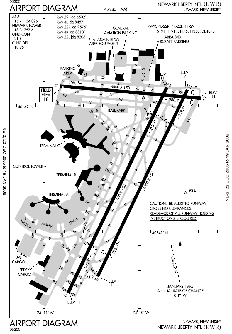
Airport diagram of Newark Liberty International Airport
This image or file is a work of a Federal Aviation Administration employee, taken or made as part of that person's official duties. As a work of the U.S. federal government, the image is in the public domain in the United States.
|
 |
Filhistorik
Klik på en dato/tid for at se filen som den så ud på det tidspunkt.
| Dato/tid | Miniaturebillede | Dimensioner | Bruger | Kommentar | |
|---|---|---|---|---|---|
| nuværende | 7. jan. 2006, 00:52 | | 791 × 1.136 (145 KB) | Cmprince | Aiport diagram of Newark Liberty International Airport {{PD-USGov-FAA}} |
Filanvendelse
Der er ingen sider der bruger denne fil.