
Fil:USA Territorial Growth 1820 alt cropped.jpg

Størrelse af denne forhåndsvisning: 800 × 489 pixels. Andre opløsninger: 320 × 196 pixels | 640 × 391 pixels | 883 × 540 pixels.
Fuld opløsning (883 × 540 billedpunkter, filstørrelse: 194 KB, MIME-type: image/jpeg)
|
|
Denne fil er fra Wikimedia Commons. Beskrivelsen af filen fra Commons er gengivet nedenfor. |
Beskrivelse
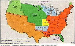
| Beskrivelse | Cropped version of map. | |||
| Dato | ||||
| Kilde | File:USA Territorial Growth 1820 alt.jpg | |||
| Forfatter | US Geological Survey, visually reorganized by User:Beyond My Ken and cropped by User:White whirlwind. | |||
| Tilladelse (Genbrug af denne fil) |
|
Filhistorik
Klik på en dato/tid for at se filen som den så ud på det tidspunkt.
| Dato/tid | Miniaturebillede | Dimensioner | Bruger | Kommentar | |
|---|---|---|---|---|---|
| nuværende | 6. jun. 2019, 21:30 | | 883 × 540 (194 KB) | White whirlwind | {{Information |description=Cropped version of map. |date=6 June 2019 |source=File:USA Territorial Growth 1820 alt.jpg |author=US Geological Survey, visually reorganized by User:Beyond My Ken and cropped by User:White whirlwind. |permission={{PD-USGov-USGS}} |other versions= }} |
Filanvendelse
Den følgende side bruger denne fil:
Global filanvendelse
Følgende andre wikier anvender denne fil:
- Anvendelser på ca.wikipedia.org
- Anvendelser på en.wikipedia.org