
Fil:Atlantic Ocean laea location map.svg

Size of this PNG preview of this SVG file: 491 × 599 pixels. Andre opløsninger: 197 × 240 pixels | 393 × 480 pixels | 629 × 768 pixels | 839 × 1.024 pixels | 1.679 × 2.048 pixels | 709 × 865 pixels.
Fuld opløsning (SVG fil, basisstørrelse 709 × 865 pixels, filstørrelse: 274 KB)
|
|
Denne fil er fra Wikimedia Commons. Beskrivelsen af filen fra Commons er gengivet nedenfor. |
Beskrivelse
| Beskrivelse |
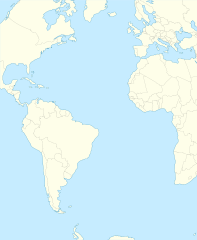
English: Relief location map of Atlantic_Ocean.
|
| Dato | |
| Kilde | Eget arbejde |
| Forfatter | Tentotwo |
Shell script for generating the map using GMT archive copy at the Wayback Machine
#!/bin/sh

# Set common options
PROJECTION=A-35.0/0.0/180/19.998266666666666c
REGION=-147.58842045747764/-48.58942183011819/77.58842045747762/48.589421830118205r
FILENAME=Atlantic_Ocean_laea_location_map.ps

# Get Natural Earth datafiles
echo "Downloading datafiles from naturalearthdata.com"
wget -nv -nc \
 http://www.naturalearthdata.com/http//www.naturalearthdata.com/download/110m/physical/110m-coastline.zip\
 http://www.naturalearthdata.com/http//www.naturalearthdata.com/download/110m/physical/110m-land.zip\
 http://www.naturalearthdata.com/http//www.naturalearthdata.com/download/110m/cultural/110m-admin-0-boundary-lines.zip
echo "...done\n"

echo "Inflating archives"
unzip 110m\*.zip
echo "...done\n"

echo "Converting shapefiles to GMT"
ogr2ogr -F GMT 110m_land.gmt 110m_land.shp
ogr2ogr -F GMT 110m_coastline.gmt 110m_coastline.shp
ogr2ogr -F GMT 110m_borders.gmt ne_110m_admin_0_boundary_lines_land.shp
echo "...done\n"

echo "Creating maps"
GMT psxy -m -J$PROJECTION -R$REGION -Bg15 -P --PAGE_COLOR=198/236/255  --POLAR_CAP=none --BASEMAP_TYPE=plain --BASEMAP_AXES=NESW --FRAME_PEN=0.15p,black 110m_land.gmt -K -G254/254/233 > $FILENAME
GMT psxy -m -J$PROJECTION -R$REGION 110m_coastline.gmt -O -K -W0.535p,9/120/171  >> $FILENAME
GMT psxy -m -J$PROJECTION -R$REGION 110m_borders.gmt -O -W100/100/100  >> $FILENAME
echo "...done\n"

echo "You can now open $FILENAME in Inkscape to clean up the file and save it as SVG. You should add an ocean coloured background and simplify the graticules using CTRL+L."

gv $FILENAME
Licensering
Jeg, dette værks ophavsretsindehaver, publicerer hermed værket under den følgende licens:
Denne fil er udgivet under Creative Commons Kreditering-Del på samme vilkår 3.0 Ikke-porteret-licensen.
- Du må frit:
- at dele – at kopiere, distribuere og overføre værket
- at remixe – at tilpasse værket
- Under følgende vilkår:
- kreditering – Du skal give passende kreditering, angive et link til licensen, og oplyse om der er foretaget ændringer. Du må gøre det på enhver fornuftig måde, men ikke på en måde der antyder at licensgiveren godkender dig eller din anvendelse.
- deling på samme vilkår – Hvis du bearbejder, ændrer eller bygger videre på dette værk, skal du distribuere dine bidrag under den samme eller en kompatibel licens som originalen.
Filhistorik
Klik på en dato/tid for at se filen som den så ud på det tidspunkt.
| Dato/tid | Miniaturebillede | Dimensioner | Bruger | Kommentar | |
|---|---|---|---|---|---|
| nuværende | 31. jan. 2012, 23:19 | | 709 × 865 (274 KB) | Tentotwo | Corrected colour of black sea |
| 31. jan. 2012, 23:17 |  | 709 × 865 (298 KB) | Tentotwo | Included border of South Sudan | |
| 31. jan. 2012, 15:38 |  | 709 × 865 (248 KB) | Tentotwo | Removed grid line | |
| 31. jan. 2012, 15:36 |  | 709 × 865 (239 KB) | Tentotwo |
Filanvendelse
Der er ingen sider der bruger denne fil.
Global filanvendelse
Følgende andre wikier anvender denne fil:
- Anvendelser på af.wikipedia.org
- Anvendelser på als.wikipedia.org
- Anvendelser på ar.wikipedia.org
- Anvendelser på ast.wikipedia.org
- Anvendelser på azb.wikipedia.org
- Anvendelser på be-tarask.wikipedia.org
- Anvendelser på be.wikipedia.org
- Anvendelser på ceb.wikipedia.org
- Plantilya:Location map Atlantic Ocean
- South Point
- Scotts Hill
- Saddle Hill
- The Ridge
- Pillar Rock
- James Bay
- Castle Hill
- Bird Island
- North Point
- West Point
- Sandy Point
- Black Point
- Powell Point
- Black Rock
- Egg Island
- East Point
- White Rock
- White Point
- Whale Point
- Long Point
- The Bluff
- Middle Point
- Crown Point
- Channel Rock
- Cave Point
- Blue Hill
- South West Point
- White Bluff
- Sandy Bay
- George Island
Vis flere globale anvendelser af denne fil.