
Fil:Cape Dezhnev USCGS 1937.PNG
Størrelse af denne forhåndsvisning: 800 × 350 pixels. Andre opløsninger: 320 × 140 pixels | 816 × 357 pixels.
Fuld opløsning (816 × 357 billedpunkter, filstørrelse: 567 KB, MIME-type: image/png)
|
|
Denne fil er fra Wikimedia Commons. Beskrivelsen af filen fra Commons er gengivet nedenfor. |
Beskrivelse
| Beskrivelse |
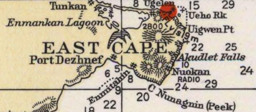
English: Detail of 1937 USCGS Bering Sea ahowing Cape Dezhnev aka East Cape with geographical features and villages marked. |
| Dato | |
| Kilde | Historical Maps and Charts Project, Office of Coast Survey, US NOAA Bering Sea Chart 9302 6_1937 http://historicalcharts.noaa.gov/historicals/historical_zoom.asp |
| Forfatter | USCGS |
Licensering
This image is in the public domain because it contains materials that originally came from the U.S. National Oceanic and Atmospheric Administration, taken or made as part of an employee's official duties.
|
Filhistorik
Klik på en dato/tid for at se filen som den så ud på det tidspunkt.
| Dato/tid | Miniaturebillede | Dimensioner | Bruger | Kommentar | |
|---|---|---|---|---|---|
| nuværende | 21. dec. 2009, 02:20 | | 816 × 357 (567 KB) | Dankarl | {{Information |Description={{en|1=Detail of 1937 USCGS Bering Sea ahowing Cape Dezhnev aka East Cape with geographical features and villages marked. }} |Source=Historical Maps and Charts Project, Office of Coast Survey, US NOAA Bering Sea Chart 9302 6_19 |
Filanvendelse
Der er ingen sider der bruger denne fil.
Global filanvendelse
Følgende andre wikier anvender denne fil:
- Anvendelser på de.wikipedia.org
- Anvendelser på en.wikipedia.org
- Anvendelser på et.wikipedia.org
- Anvendelser på fi.wikipedia.org
- Anvendelser på fr.wikipedia.org
- Anvendelser på ja.wikipedia.org
- Anvendelser på nl.wikipedia.org
- Anvendelser på zh.wikipedia.org