
Fil:East Sussex UK locator map 2010.svg

Size of this PNG preview of this SVG file: 494 × 600 pixels. Andre opløsninger: 198 × 240 pixels | 395 × 480 pixels | 633 × 768 pixels | 843 × 1.024 pixels | 1.687 × 2.048 pixels | 1.108 × 1.345 pixels.
Fuld opløsning (SVG fil, basisstørrelse 1.108 × 1.345 pixels, filstørrelse: 302 KB)
|
|
Denne fil er fra Wikimedia Commons. Beskrivelsen af filen fra Commons er gengivet nedenfor. |
Beskrivelse
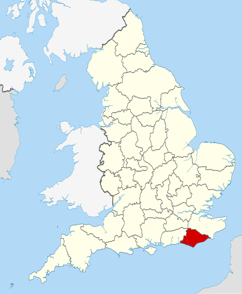
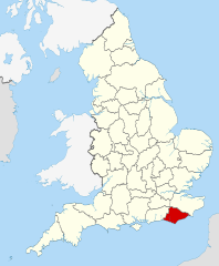
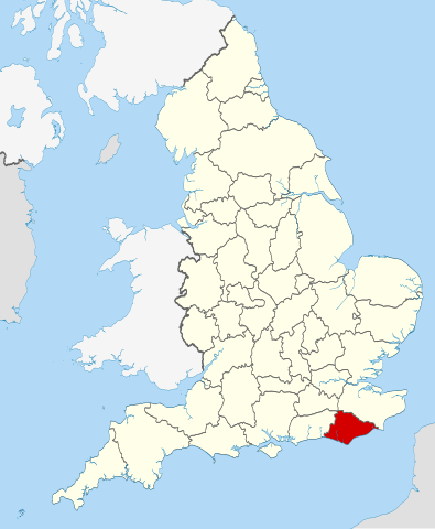
| Beskrivelse | Location of the ceremonial county of East Sussex within England. |
| Dato | |
| Kilde |
National Geospatial-Intelligence Agency
|
| Forfatter | Nilfanion |
Licensering
Jeg, dette værks ophavsretsindehaver, udgiver hermed værket under den følgende licens:
Denne fil er udgivet under Creative Commons Kreditering-Del på samme vilkår 3.0 Ikke-porteret-licensen.
- Du må frit:
- at dele – at kopiere, distribuere og overføre værket
- at remixe – at tilpasse værket
- Under følgende vilkår:
- kreditering – Du skal give passende kreditering, angive et link til licensen, og oplyse om der er foretaget ændringer. Du må gøre det på enhver fornuftig måde, men ikke på en måde der antyder at licensgiveren godkender dig eller din anvendelse.
- deling på samme vilkår – Hvis du bearbejder, ændrer eller bygger videre på dette værk, skal du distribuere dine bidrag under den samme eller en kompatibel licens som originalen.

|
Tilladelse er givet til at kopiere, distribuere og/eller ændre dette dokument under betingelserne i GNU Free Documentation License', Version 1.2 eller enhver senere version udgivet af Free Software Foundation; uden et invariant afsnit, ingen forsidetekster, og ingen bagsidetekst. En kopi af licensen er inkluderet i afsnittet GNU Free Documentation License. |
Du kan vælge den licens du foretrækker.

|
This is one of the images forming part of the Valued image set: Locator maps of the Ceremonial counties of England on Wikimedia Commons. The image set has been assessed under the valued image set criteria and is considered the most valued set on Commons within the scope:
Locator maps of the Ceremonial counties of England
You can see its nomination at Commons:Valued image candidates/Locator maps of English ceremonial counties. |
Filhistorik
Klik på en dato/tid for at se filen som den så ud på det tidspunkt.
| Dato/tid | Miniaturebillede | Dimensioner | Bruger | Kommentar | |
|---|---|---|---|---|---|
| nuværende | 24. nov. 2010, 00:35 | | 1.108 × 1.345 (302 KB) | Nilfanion | == Summary == {{Information |Description=Location of the ceremonial county of East Sussex within England. |Source=Ordnance Survey [https://www.ordnancesurvey.co.uk/opendatadownload/products.html OpenData]: *County b |
Filanvendelse
Der er ingen sider der bruger denne fil.
Global filanvendelse
Følgende andre wikier anvender denne fil:
- Anvendelser på af.wikipedia.org
- Anvendelser på ar.wikipedia.org
- Anvendelser på ast.wikipedia.org
- Anvendelser på be-tarask.wikipedia.org
- Anvendelser på bg.wikipedia.org
- Anvendelser på ca.wikipedia.org
- Anvendelser på ceb.wikipedia.org
- Anvendelser på cs.wikipedia.org
- Anvendelser på dag.wikipedia.org
- Anvendelser på en.wikipedia.org
- Sussex
- East Sussex
- Cliffe Hill
- Upper Hartfield
- Icklesham
- Withdean
- Fletching, East Sussex
- Dallington, East Sussex
- East Guldeford
- Iden, East Sussex
- Playden
- Rye Foreign
- Udimore
- Little Horsted
- Wartling
- St Ann Without
- Preston, Brighton
- Denton, East Sussex
- Chailey Common
- Newhaven Seaplane Base
- Lullington, East Sussex
- East Blatchington
- Darwell Reservoir
- Winchelsea Beach
- Plumpton Racecourse
- River Uck
- Ridgewood, East Sussex
- Template:EastSussex-geo-stub
- Hove Park
- Sussex Ouse Valley Way
- Baldslow
- Belmont, East Sussex
- Rock-a-Nore
- Gensing, East Sussex
- Sussex Border Path
- Broad Oak, Wealden
- Salehurst and Robertsbridge
- Sidley, East Sussex
Vis flere globale anvendelser af denne fil.