
Fil:ScotlandMoray.png
Størrelse af denne forhåndsvisning: 480 × 599 pixels. Andre opløsninger: 192 × 240 pixels | 384 × 480 pixels | 615 × 768 pixels | 820 × 1.024 pixels | 1.641 × 2.048 pixels | 2.733 × 3.411 pixels.
Fuld opløsning (2.733 × 3.411 billedpunkter, filstørrelse: 216 KB, MIME-type: image/png)
|
|
Denne fil er fra Wikimedia Commons. Beskrivelsen af filen fra Commons er gengivet nedenfor. |

|
En vektorversion af dette billede (SVG) er tilgængelig. Det bør bruges i stedet for punktgrafikbilledet når det er fordelagtigt.
File:ScotlandMoray.png → File:ScotlandMoray.svg
For mere information om vektorgrafik: Læs om overgangen til SVG på Commons. Se også information om MediaWikis understøttelse af SVG-billeder. |
 |
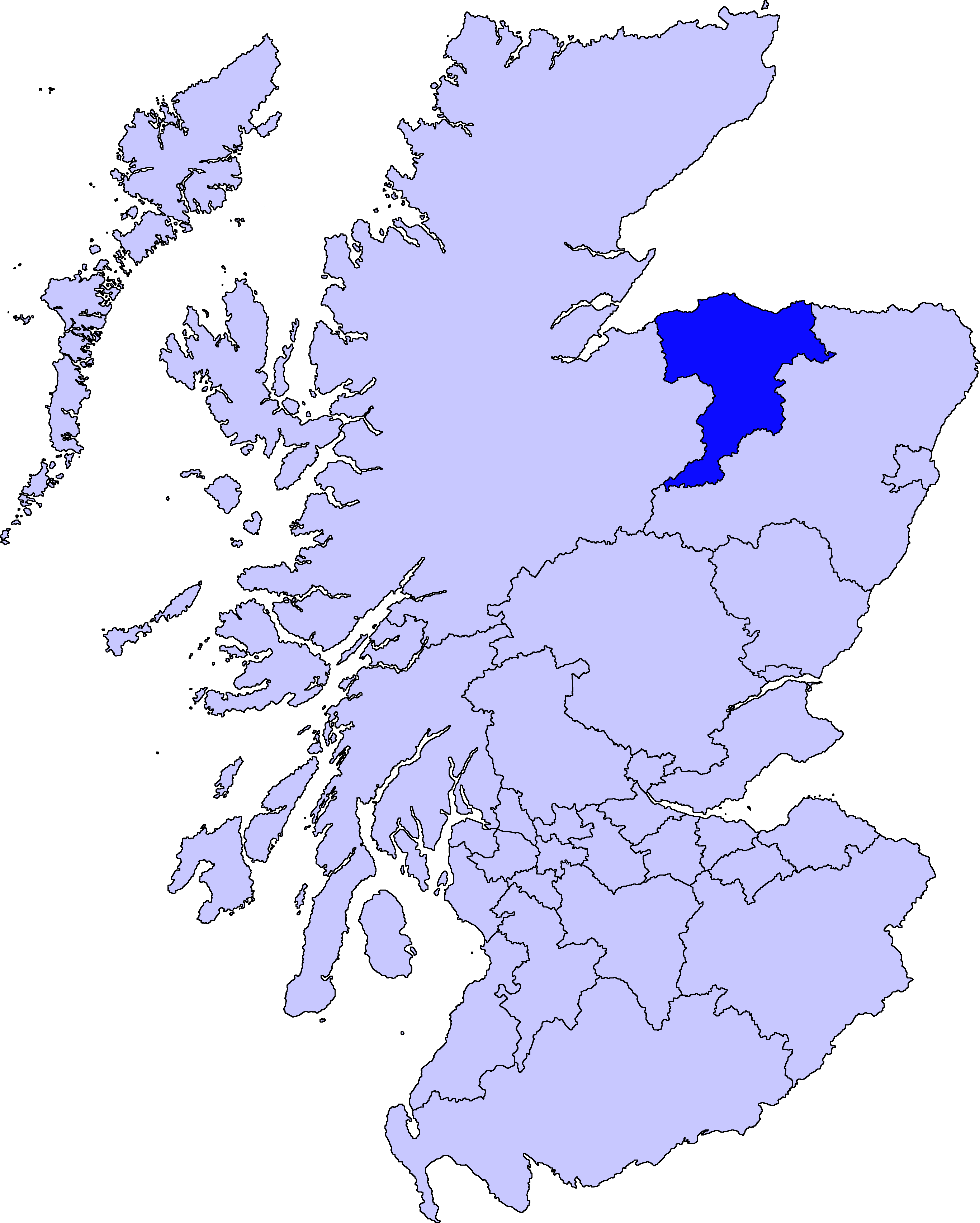
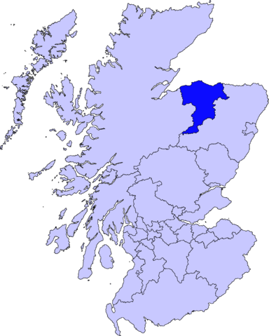
Moray unitary council
Slightly edited version of a map drawn by Morwen

|
Tilladelse er givet til at kopiere, distribuere og/eller ændre dette dokument under betingelserne i GNU Free Documentation License', Version 1.2 eller enhver senere version udgivet af Free Software Foundation; uden et invariant afsnit, ingen forsidetekster, og ingen bagsidetekst. En kopi af licensen er inkluderet i afsnittet GNU Free Documentation License. |
| Denne fil er udgivet under Creative Commons Kreditering-Del på samme vilkår 3.0 Ikke-porteret-licensen. | ||
| ||
| Denne licens blev tilføjet som en del af GFDL-licensopdateringen. |
Filhistorik
Klik på en dato/tid for at se filen som den så ud på det tidspunkt.
| Dato/tid | Miniaturebillede | Dimensioner | Bruger | Kommentar | |
|---|---|---|---|---|---|
| nuværende | 11. aug. 2010, 03:46 | | 2.733 × 3.411 (216 KB) | Alphathon | New, larger, transparent background version based on the Angus map |
| 17. maj 2005, 23:38 |  | 200 × 230 (4 KB) | Voyager | Moray unitary council Slightly edited version of a map drawn by Morwen {{GFDL}} Category:Maps of Scottish unitary councils |
Filanvendelse
Der er ingen sider der bruger denne fil.
Global filanvendelse
Følgende andre wikier anvender denne fil:
- Anvendelser på bg.wikipedia.org
- Anvendelser på cy.wikipedia.org
- Anvendelser på de.wikipedia.org
- Anvendelser på en.wikipedia.org
- Maggieknockater
- Moray
- Elgin, Moray
- Dufftown
- Forres
- Lossiemouth
- Burghead
- Talk:Moray
- Buckie
- Findochty
- Fochabers
- Aberlour
- Cullen, Moray
- Tomintoul
- Keith, Moray
- Mosstodloch
- Archiestown
- Rothes
- Findhorn
- Kinloss, Scotland
- Portknockie
- Achnastank
- Drummuir
- Rathven
- Dallas, Moray
- Longmorn
- Kingston, Moray
- Auchindoun, Moray
- Fogwatt
- Craigellachie, Moray
- Newmill
- Cummingston
- Hopeman
- Duffus
- Ballindalloch
- Urquhart, Moray
- Lhanbryde
- Spey Bay
- Rafford
- Findhorn Ecovillage
- Ianstown
- Strathlene
- Alves, Moray
- Ashgrove, Moray
- Auchbreck
Vis flere globale anvendelser af denne fil.