Fil:The Downs Anchorage.jpg

Page contents not supported in other languages.
Fra Wikipedia, den frie encyklopædi

Fuld opløsning(1.171 × 1.323 billedpunkter, filstørrelse: 211 KB, MIME-type: image/jpeg)


Denne fil er fra Wikimedia Commons

Beskrivelse

Beskrivelse
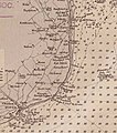
English: Chart showing position of The Downs off the coast of kent. From Admiralty Chart No 1895, published 1848
Dato
Kilde Cropped from Admiralty Chart No 1895 England south coast sheet 7 Dungeness to the Thames including Dover Strait, Published 1848.jpg
Forfatter
United Kingdom Hydrographic Office    wikidata:Q2495231
 
Alternative navne
UK Hydrographic Office; UKHO; Hydrographic Office of the Admiralty
Autoritetsdata
creator QS:P170,Q2495231

Licensering

Public domain
This work created by the United Kingdom Government is in the public domain.

This is because it is one of the following:

  1. It is a photograph taken prior to 1 June 1957; or
  2. It was published prior to 1974; or
  3. It is an artistic work other than a photograph or engraving (e.g. a painting) which was created prior to 1974.

HMSO has declared that the expiry of Crown Copyrights applies worldwide (ref: HMSO Email Reply)
More information.

See also Copyright and Crown copyright artistic works.

Deutsch  English  Español  français  italiano  Nederlands  polski  português  sicilianu  slovenščina  suomi  Türkçe  македонски  русский  українська  മലയാളം  한국어  日本語  简体中文  繁體中文  العربية  +/−

Captions

Tilføj en kort forklaring på en enkelt linje om hvad filen viser
Chart showing position of The Downs off the coast of kent

Elementer som er med i denne fil

afbilder

Filhistorik

Klik på en dato/tid for at se filen som den så ud på det tidspunkt.

Dato/tidMiniaturebilledeDimensionerBrugerKommentar
nuværende22. nov. 2019, 10:11Miniature af versionen fra 22. nov. 2019, 10:111.171 × 1.323 (211 KB)KognosUser created page with UploadWizard

Der er ingen sider der bruger denne fil.

Global filanvendelse

Følgende andre wikier anvender denne fil: