
Fil:Greenland stub.svg

Size of this PNG preview of this SVG file: 343 × 600 pixels. Andre opløsninger: 137 × 240 pixels | 274 × 480 pixels | 439 × 768 pixels | 585 × 1.024 pixels | 1.171 × 2.048 pixels | 454 × 794 pixels.
Fuld opløsning (SVG fil, basisstørrelse 454 × 794 pixels, filstørrelse: 46 KB)
|
|
Denne fil er fra Wikimedia Commons. Beskrivelsen af filen fra Commons er gengivet nedenfor. |
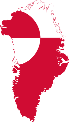
| Beskrivelse | Map of Greenland with flag. | ||
| Dato | |||
| Kilde | Map shape is from Image:Greenland big.png, colors and dimensions are from Image:Flag of Greenland.svg | ||
| Forfatter | PavelD | ||
| Tilladelse (Genbrug af denne fil) |
|
||
| Andre versioner |
  .svg) |
Filhistorik
Klik på en dato/tid for at se filen som den så ud på det tidspunkt.
| Dato/tid | Miniaturebillede | Dimensioner | Bruger | Kommentar | |
|---|---|---|---|---|---|
| nuværende | 6. jun. 2019, 15:11 | | 454 × 794 (46 KB) | Minorax | Reverted to version as of 07:26, 23 February 2011 (UTC) Highly used file, kindly use File:Test.svg to test your code, Alternatively, you can contact COM:GL/ILL |
| 6. jun. 2019, 10:32 |  | 606 × 893 (93 KB) | Entity Valkyrie | Sorry, the preview was not accurate. Colour was not added. Or was it that the file failed to load? | |
| 6. jun. 2019, 10:28 |  | 606 × 893 (93 KB) | Entity Valkyrie | Color added! | |
| 1. jun. 2019, 05:58 |  | 288 × 425 (3 KB) | Entity Valkyrie | More familiar | |
| 23. feb. 2011, 09:26 |  | 454 × 794 (46 KB) | Fry1989 | made the file too big, lets see if this way works better | |
| 23. feb. 2011, 09:23 |  | 455 × 794 (85 KB) | Fry1989 | better border I hope | |
| 15. dec. 2010, 01:01 |  | 454 × 793 (47 KB) | Fry1989 | better, same file just an overhaul | |
| 6. dec. 2006, 02:09 |  | 461 × 800 (90 KB) | PaD | {{Information |Description=Map of Greenland with flag. |Source=Map shape is from Image:Greenland big.png, colors and dimensions are from Image:Flag of Greenland.svg |Date=2006-12-06 |Author=PavelD |Permission={{PD-self}} |other_v |
Filanvendelse
De følgende 73 sider bruger denne fil:
- Agssaussat
- Akunnaap Nunaa
- Alanngorsuaq
- Alluitsoq
- Ammassalik Ø
- Ammassivik
- Avannaata Kommune
- British Arctic Air Route Expedition
- Camp Century
- Demokraterne (grønlandsk parti)
- Disko
- Diskobugten
- Ella Ø
- Eqalugaarsuit
- Folkeafstemningen om Grønlands EF-medlemskab 1982
- Folkeafstemningen om alkoholforbud i Grønland 1978
- Folkeafstemningen om grønlandsk selvstyre 2008
- Folkeafstemningen om hjemmestyre 1979
- Grønland-Skotland Ryggen
- Grønlandske kap og forbjerge
- Gunnbjørns fjeld
- Itilleq
- Jakobshavn Isbræ
- Kap Alexander
- Kap Bridgman
- Kap York
- Kiatak
- Kong Christian IX Land
- Kong Oscars fjord
- Kronprins Christian Land
- Kronprins Frederik land
- Kujalleq Kommune
- Lake Ferguson
- Lincolnhavet
- Melville Bugt
- Nanortalik Kommune
- Narsaq Lokalområde
- Narsarmijit
- Nioghalvfjerdsfjorden
- Nioghalvfjerdsfjordsgletsjeren
- Nordostrundingen
- Nunatta Qitornai
- Nuugaarsuk
- Nuuk Kommune
- P-Mountain
- Paamiut Kommune
- Partii Inuit
- Politiske valg i Grønland
- Qaasuitsup Kommune
- Qasigiannguit Kommune
- Qassimiut
- Qeqertalik Kommune
- Qeqertarsuaq Kommune
- Qeqertarsuatsiaat Kangerluat
- Qeqertarsuatsiaq (Qeqertarsuatsiaat)
- Qeqqata Kommune
- Qullissat
- Rigsfællesskabet
- Samarbejdspartiet
- Scoresby Sund
- Sermersooq Kommune
- Sermitsiaq
- Sisimiut Kommune
- Siumup Inuusuttunut Suleqatigiiffia
- Tasiusaq (Kujalleq)
- Traill Ø
- Tupertalik
- Uummannaq Kommune
- Uunartoq Qeqertaq
- Wandelhavet
- Bruger:C.Thure/Stubskabeloner/Geografi
- Skabelon:GL-geostub
- Skabelon:GL-politikstub
Global filanvendelse
Følgende andre wikier anvender denne fil:
- Anvendelser på ar.wikipedia.org
- جرينلاند
- نوك
- بوابة:جرينلاند
- قالب:تقسيمات جرينلاند
- كيكاتا
- حديقة شمال شرق جرينلاند الوطنية
- إيفيتوت
- آسيات (مدينة)
- تاسيلاك
- إيلوليسات
- قاعدة ثول الجوية
- مانيتسوك
- باميوت
- بيتوفيك
- سيسيميوت
- التقسيم الإداري في جرينلاند
- سيرمرسوك
- كانجرسواتسيك
- كاسويتسوب
- كوياليك
- بوابة:جرينلاند/قوالب
- جغرافيا جرينلاند
- أفاناتا
- قيقرتليك
- Anvendelser på ca.wikipedia.org
- Terra d'Eric el Roig
- Història de Groenlàndia
- Mitologia inuit
- Primer ministre de Groenlàndia
- Eleccions a Groenlàndia
- Parlament de Groenlàndia
- Bandera de Groenlàndia
- Cultura Dorset
- Cultura de Thule
- Glacera continental groenlandesa
- Accident de Thule
- Hans Egede
- Kalaallit
- Paleoesquimals
- Divisió administrativa de Groenlàndia
- Tractat de Kiel
- Parc Nacional del Nord-est de Groenlàndia
- Assentament Oriental
- Assentament Occidental
- Skræling
- Assentaments vikings a Groenlàndia
- Nòrdic groenlandès
- Plantilla:Groenlàndia
- Tunumiit
- Anvendelser på ce.wikipedia.org
Vis flere globale anvendelser af denne fil.