
Fil:Aerial view of the Central Intelligence Agency headquarters, Langley, Virginia - Corrected and Cropped.jpg
Størrelse af denne forhåndsvisning: 800 × 356 pixels. Andre opløsninger: 320 × 142 pixels | 640 × 284 pixels | 1.024 × 455 pixels | 1.280 × 569 pixels | 2.560 × 1.138 pixels | 5.523 × 2.455 pixels.
Fuld opløsning (5.523 × 2.455 billedpunkter, filstørrelse: 7,57 MB, MIME-type: image/jpeg)
|
|
Denne fil er fra Wikimedia Commons. Beskrivelsen af filen fra Commons er gengivet nedenfor. |
Beskrivelse
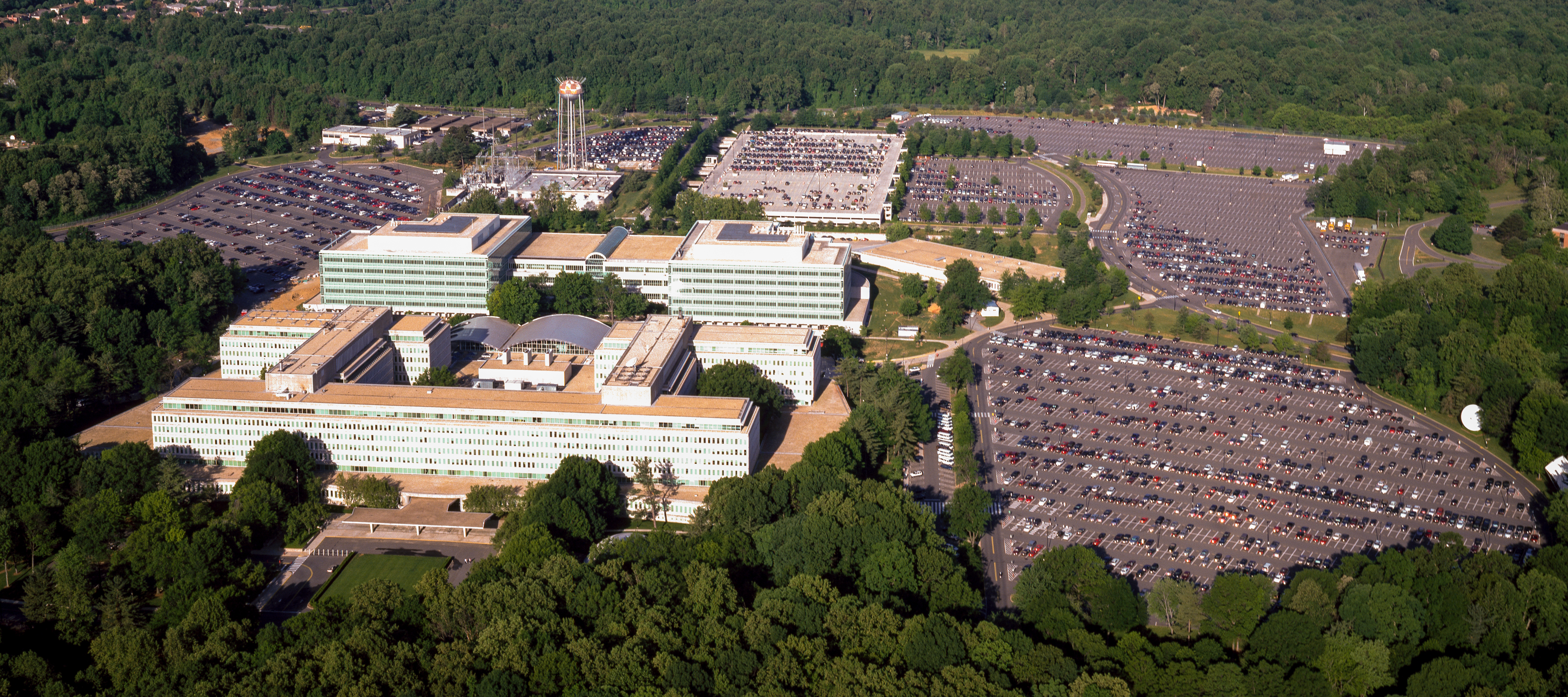
| Aerial view of the Central Intelligence Agency headquarters, Langley, Virginia
( |
|||||||||||||||||||||||||||
|---|---|---|---|---|---|---|---|---|---|---|---|---|---|---|---|---|---|---|---|---|---|---|---|---|---|---|---|
| Forfatter |
|
||||||||||||||||||||||||||
| Titel |
Aerial view of the Central Intelligence Agency headquarters, Langley, Virginia |
||||||||||||||||||||||||||
| Depicted place | Central Intelligence Agency headquarters | ||||||||||||||||||||||||||
| Dato | mellem 1980 og 2006 | ||||||||||||||||||||||||||
| Teknik | 1 transparency : color | ||||||||||||||||||||||||||
| Mål | 4 x 5 in. or smaller. | ||||||||||||||||||||||||||
| Samling |
|
||||||||||||||||||||||||||
| Nuværende placering |
Prints and Photographs Division http://hdl.loc.gov/loc.pnp/pp.print |
||||||||||||||||||||||||||
| Noter |
|
||||||||||||||||||||||||||
| Kilde |
|
||||||||||||||||||||||||||
| Tilladelse (Genbrug af denne fil) |
Rights Advisory: No known restrictions on publication. | ||||||||||||||||||||||||||
| Andre versioner |
|
||||||||||||||||||||||||||


| | Dette og andre billeder på deres position på: OpenStreetMap |
Licensering
| This work is from the Carol M. Highsmith Archive collection at the Library of Congress. According to the library, there are no known copyright restrictions on the use of this work. Carol M. Highsmith has stipulated that her photographs are in the public domain. Photographs of sculpture or other works of art may be restricted by the copyright of the artist. |
 |
Filhistorik
Klik på en dato/tid for at se filen som den så ud på det tidspunkt.
| Dato/tid | Miniaturebillede | Dimensioner | Bruger | Kommentar | |
|---|---|---|---|---|---|
| nuværende | 22. apr. 2017, 18:17 | | 5.523 × 2.455 (7,57 MB) | Falcorian | User created page with UploadWizard |
Filanvendelse
De følgende 5 sider bruger denne fil:
Global filanvendelse
Følgende andre wikier anvender denne fil:
- Anvendelser på ar.wikipedia.org
- Anvendelser på arz.wikipedia.org
- Anvendelser på ast.wikipedia.org
- Anvendelser på azb.wikipedia.org
- Anvendelser på az.wikipedia.org
- Anvendelser på br.wikipedia.org
- Anvendelser på ca.wikipedia.org
- Anvendelser på ce.wikipedia.org
- Anvendelser på cs.wikipedia.org
- Anvendelser på cy.wikipedia.org
- Anvendelser på de.wikipedia.org
- Anvendelser på en.wikipedia.org
- Anvendelser på eo.wikipedia.org
- Anvendelser på eo.wikiquote.org
- Anvendelser på es.wikipedia.org
- Anvendelser på fi.wikipedia.org
- Anvendelser på fr.wikipedia.org
- Anvendelser på fr.wikinews.org
- Anvendelser på ga.wikipedia.org
- Anvendelser på ha.wikipedia.org
- Anvendelser på he.wikipedia.org
- Anvendelser på hu.wikipedia.org
- Anvendelser på id.wikipedia.org
- Anvendelser på it.wikipedia.org
- Anvendelser på ja.wikipedia.org
- Anvendelser på ko.wikipedia.org
- Anvendelser på ky.wikipedia.org
- Anvendelser på lt.wikipedia.org
- Anvendelser på lv.wikipedia.org
- Anvendelser på mn.wikipedia.org
- Anvendelser på ne.wikipedia.org
- Anvendelser på nn.wikipedia.org
- Anvendelser på no.wikipedia.org
- Anvendelser på ro.wikipedia.org
- Anvendelser på ru.wikipedia.org
- Anvendelser på ru.wikinews.org
- Anvendelser på sk.wikipedia.org
- Anvendelser på sl.wikipedia.org
- Anvendelser på sr.wikipedia.org
- Anvendelser på te.wikipedia.org
- Anvendelser på tg.wikipedia.org
Vis flere globale anvendelser af denne fil.