
Fil:Asker Line map.jpg
Fuld opløsning (898 × 575 billedpunkter, filstørrelse: 129 KB, MIME-type: image/jpeg)
|
|
Denne fil er fra Wikimedia Commons. Beskrivelsen af filen fra Commons er gengivet nedenfor. |
| Beskrivelse |
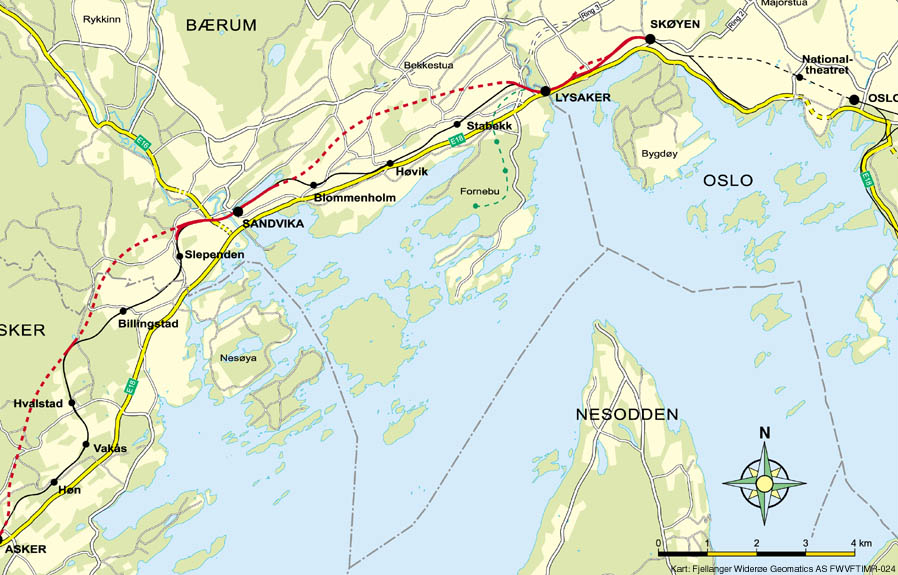
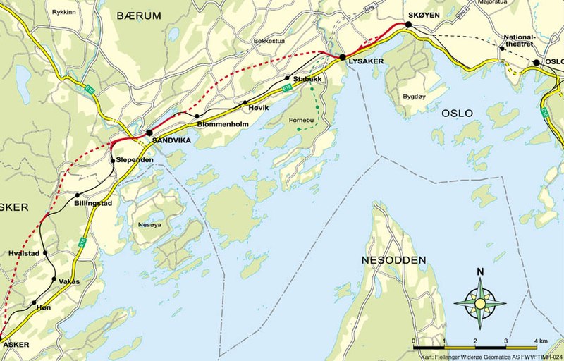
English: Map of the Asker Line west of Oslo, Norway. Red line is the Asker Line and black line is the Drammen Line. Dotted lines are tunnels. Black dots are stations. The green line is the Fornebu Line. The yellow lines indicate European Routes E16 and E18. |
|||
| Kilde | http://www.jernbaneverket.no/multimedia/archive/01417/Kart_Sk_yen-Asker_1417793a.jpg | |||
| Forfatter | Jernbaneverket / Norwegian National Rail Administration | |||
| Tilladelse (Genbrug af denne fil) |
|

|

|
Dette billede (eller alle billederne i denne artikel eller kategori) bør genskabes ved hjælp af vektorgrafik som en SVG-fil. Dette har flere fordele; se Commons:Media for cleanup for mere information. Hvis der eksisterer en SVG-version af dette billede, så vær venlig at lægge den op. Efter en SVG-version er blevet lagt op, så erstat denne skabelon med {{Vector version available|nyt billedes navn.svg}} på denne side.
|


Filhistorik
Klik på en dato/tid for at se filen som den så ud på det tidspunkt.
| Dato/tid | Miniaturebillede | Dimensioner | Bruger | Kommentar | |
|---|---|---|---|---|---|
| nuværende | 7. maj 2020, 12:56 | | 898 × 575 (129 KB) | Tholme | Cropped 3 % horizontally, 5 % vertically using CropTool with lossless mode. Remove border |
| 18. nov. 2008, 20:58 |  | 926 × 603 (136 KB) | Arsenikk | {{Information |Description={{en|1=Map of the Asker Line west of Oslo, Norway. Red line is the Asker Line and black line is the Drammen Line. Dotted lines are tunnels. Black dots are stati |
Filanvendelse
Den følgende side bruger denne fil:
Global filanvendelse
Følgende andre wikier anvender denne fil:
- Anvendelser på de.wikipedia.org
- Anvendelser på en.wikipedia.org
- Anvendelser på fr.wikipedia.org
- Anvendelser på id.wikipedia.org
- Anvendelser på nl.wikipedia.org
- Anvendelser på nn.wikipedia.org
- Anvendelser på no.wikipedia.org
- Anvendelser på pl.wikipedia.org
- Anvendelser på sv.wikipedia.org
- Anvendelser på www.wikidata.org