
Fil:Blank Iowa county map with county names.svg

Size of this PNG preview of this SVG file: 776 × 600 pixels. Andre opløsninger: 311 × 240 pixels | 621 × 480 pixels | 994 × 768 pixels | 1.280 × 989 pixels | 2.560 × 1.978 pixels | 792 × 612 pixels.
Fuld opløsning (SVG fil, basisstørrelse 792 × 612 pixels, filstørrelse: 291 KB)
|
|
Denne fil er fra Wikimedia Commons. Beskrivelsen af filen fra Commons er gengivet nedenfor. |
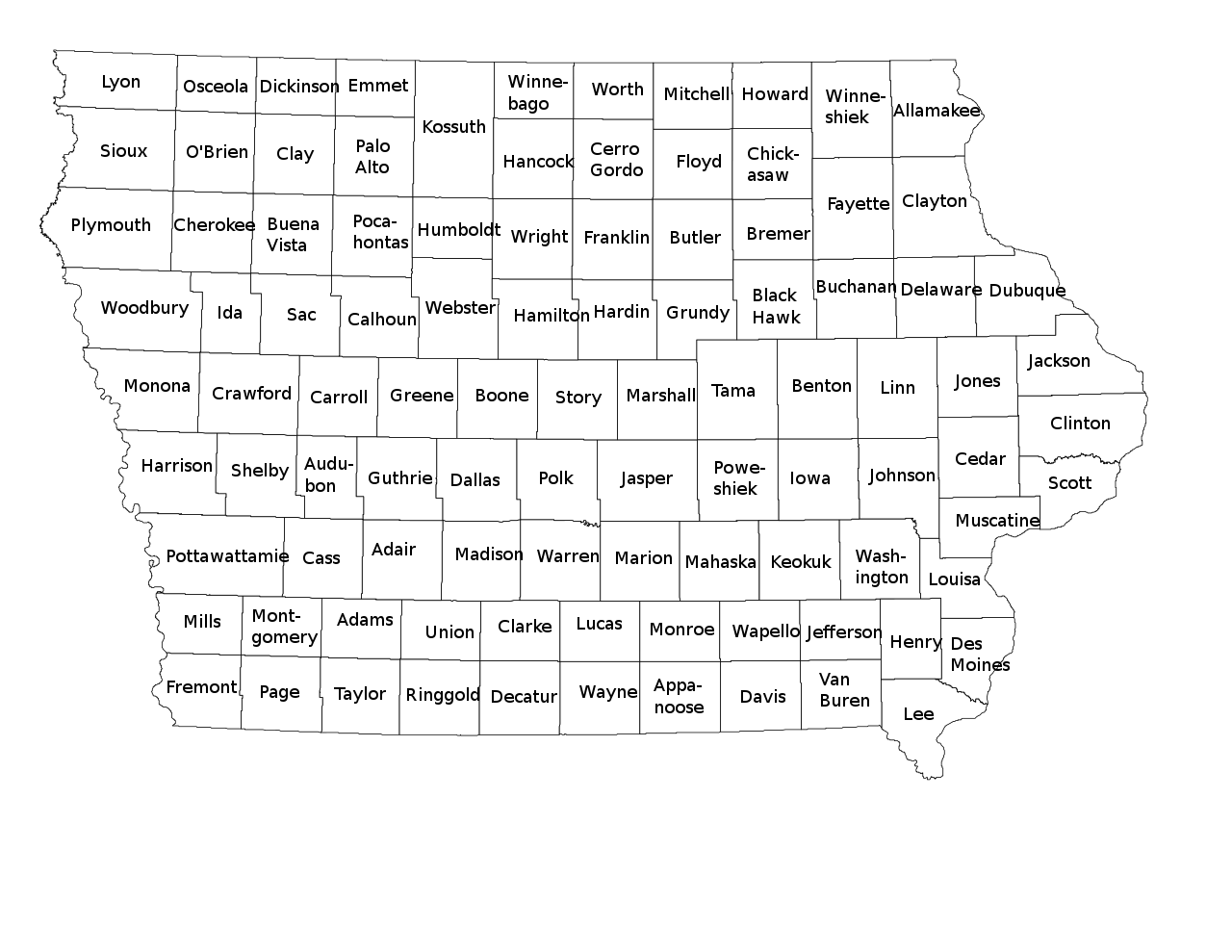
| Beskrivelse | A blank map of Iowa showing county borders and county names. | ||
| Dato | |||
| Kilde |
Eget arbejde, This vector image includes elements that have been taken or adapted from this file: |
||
| Forfatter | Philosopher. | ||
| Tilladelse (Genbrug af denne fil) |
Jeg, dette værks ophavsretsindehaver, udgiver hermed værket under den følgende licens: Denne fil er udgivet under Creative Commons Kreditering-Del på samme vilkår 3.0 Ikke-porteret-licensen.
Du kan vælge den licens du foretrækker. |
||
| Andre versioner | File:Blank Iowa county map.svg for a similar SVG version without county names. |

Filhistorik
Klik på en dato/tid for at se filen som den så ud på det tidspunkt.
| Dato/tid | Miniaturebillede | Dimensioner | Bruger | Kommentar | |
|---|---|---|---|---|---|
| nuværende | 27. sep. 2020, 10:46 | | 792 × 612 (291 KB) | DemonDays64 | Fix misspelling of "Harrison" as "Harriosn" |
| 27. jan. 2015, 01:39 |  | 792 × 612 (291 KB) | Philosopher | {{Information |Description=A blank map of Iowa showing county borders and county names. |Source={{own}}, {{AttribSVG|1=NRHP Iowa Map.svg|2=25or6to4}} |Date=2015-01-26 |Author=Philosopher. |Permission={{self|cc-by-sa-3.0|GFDL}} |oth... |
Filanvendelse
Den følgende side bruger denne fil:
Global filanvendelse
Følgende andre wikier anvender denne fil:
- Anvendelser på fi.wikipedia.org