
Fil:Map of the Territory of the Iceni.svg

Size of this PNG preview of this SVG file: 424 × 600 pixels. Andre opløsninger: 170 × 240 pixels | 339 × 480 pixels | 543 × 768 pixels | 724 × 1.024 pixels | 1.448 × 2.048 pixels | 744 × 1.052 pixels.
Fuld opløsning (SVG fil, basisstørrelse 744 × 1.052 pixels, filstørrelse: 151 KB)
|
|
Denne fil er fra Wikimedia Commons. Beskrivelsen af filen fra Commons er gengivet nedenfor. |
| Beskrivelse |
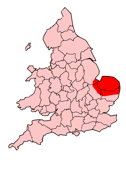
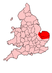
English: A map showing the territory of the Iceni tribe overlayed in red in the context of the modern county boundaries of England and wales |
| Dato | (UTC) |
| Kilde | |
| Forfatter |
|
.svg)
.png)
| Dette er et retoucheret billede, hvilket betyder, at det er blevet digitalt ændret fra sin oprindelige version. Ændringer: Revised to show extent of Iceni Territory. Originalen kan ses her: Map of the Territory of the Dobunni.svg. Ændringer blev udført af Jpb1301.
|
Denne fil er udgivet under Creative Commons Kreditering-Del på samme vilkår 3.0 Ikke-porteret-licensen.
- Du må frit:
- at dele – at kopiere, distribuere og overføre værket
- at remixe – at tilpasse værket
- Under følgende vilkår:
- kreditering – Du skal give passende kreditering, angive et link til licensen, og oplyse om der er foretaget ændringer. Du må gøre det på enhver fornuftig måde, men ikke på en måde der antyder at licensgiveren godkender dig eller din anvendelse.
- deling på samme vilkår – Hvis du bearbejder, ændrer eller bygger videre på dette værk, skal du distribuere dine bidrag under den samme eller en kompatibel licens som originalen.
Oprindelig oplægningslog
This image is a derivative work of the following images:
- File:England_Celtic_tribes_-_South.png licensed with Cc-by-sa-3.0-migrated, GFDL
- 2007-11-16T12:21:48Z File Upload Bot (Magnus Manske) 550x297 (105767 Bytes) {{BotMoveToCommons|en.wikipedia}} {{Information |Description={{en|Image depicting the Celts of South England, pre-[[:en:Roman Britain]] times. I created this myself, under the guidence (to find location of them) of [http://w
- File:Map_of_the_Territory_of_the_Dobunni.svg licensed with Cc-by-sa-3.0, GFDL
- 2009-10-13T19:47:34Z Jpb1301 744x1052 (151192 Bytes) {{Information |Description={{en|1=A map showing the territory of the Dobunni tribe overlayed in red in the context of the modern county boundaries of England and wales}} |Source=*[[:File:Map_of_the_Territory_of_the_Dobunni.sv
- 2009-10-13T17:38:36Z Jpb1301 744x1052 (151194 Bytes) {{Information |Description={{en|1=A map showing the territory of the Dobunni tribe overlayed in red in the context of the modern county boundaries of England and wales}} |Source=*[[:File:Map_of_the_Territory_of_the_Cornovii_(
Uploaded with derivativeFX
Filhistorik
Klik på en dato/tid for at se filen som den så ud på det tidspunkt.
| Dato/tid | Miniaturebillede | Dimensioner | Bruger | Kommentar | |
|---|---|---|---|---|---|
| nuværende | 24. okt. 2009, 21:30 | | 744 × 1.052 (151 KB) | Jpb1301 | {{Information |Description={{en|1=A map showing the territory of the Iceni tribe overlayed in red in the context of the modern county boundaries of England and wales}} |Source=*File:England_Celtic_tribes_-_South.png *[[:File:Map_of_the_Territory_of_ |
Filanvendelse
Den følgende side bruger denne fil:
Global filanvendelse
Følgende andre wikier anvender denne fil:
- Anvendelser på ar.wikipedia.org
- Anvendelser på bg.wikipedia.org
- Anvendelser på br.wikipedia.org
- Anvendelser på ca.wikipedia.org
- Anvendelser på en.wikipedia.org
- Anvendelser på es.wikipedia.org
- Anvendelser på fa.wikipedia.org
- Anvendelser på fi.wikipedia.org
- Anvendelser på he.wikipedia.org
- Anvendelser på hr.wikipedia.org
- Anvendelser på hy.wikipedia.org
- Anvendelser på id.wikipedia.org
- Anvendelser på it.wikipedia.org
- Anvendelser på ja.wikipedia.org
- Anvendelser på la.wikipedia.org
- Anvendelser på nl.wikipedia.org
- Anvendelser på no.wikipedia.org
- Anvendelser på pl.wikipedia.org
- Anvendelser på pt.wikipedia.org
- Anvendelser på ro.wikipedia.org
- Anvendelser på ru.wikipedia.org
- Anvendelser på si.wikipedia.org
- Anvendelser på sv.wikipedia.org
- Anvendelser på uk.wikipedia.org
- Anvendelser på ur.wikipedia.org