
Fil:Old Georgia State Capitol.jpg

Størrelse af denne forhåndsvisning: 800 × 543 pixels. Andre opløsninger: 320 × 217 pixels | 640 × 435 pixels | 1.024 × 696 pixels | 1.280 × 870 pixels | 2.560 × 1.739 pixels | 4.697 × 3.191 pixels.
Fuld opløsning (4.697 × 3.191 billedpunkter, filstørrelse: 2 MB, MIME-type: image/jpeg)
|
|
Denne fil er fra Wikimedia Commons. Beskrivelsen af filen fra Commons er gengivet nedenfor. |
| Kameraposition | | Dette og andre billeder på deres position på: OpenStreetMap |
|---|
| Beskrivelse |
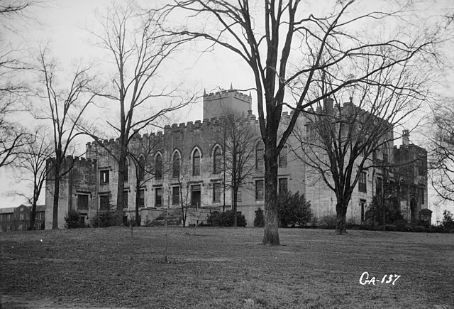
English: Old State Capitol, Milledgeville, Baldwin County, GA - General view. |
|||||
| Dato | ||||||
| Kilde | Library of Congress, Prints and Photographs Division: Historic American Buildings Survey, HABS: GA,5-MILG,6-2 | |||||
| Forfatter | L. D. Andrew, photographer | |||||
| Tilladelse (Genbrug af denne fil) |
|


|
This image is available from the United States Library of Congress's Prints and Photographs division
under the digital ID hhh.ga0306. This tag does not indicate the copyright status of the attached work. A normal copyright tag is still required. See Commons:Licensing.
|
Filhistorik
Klik på en dato/tid for at se filen som den så ud på det tidspunkt.
| Dato/tid | Miniaturebillede | Dimensioner | Bruger | Kommentar | |
|---|---|---|---|---|---|
| nuværende | 5. apr. 2009, 17:00 | | 4.697 × 3.191 (2 MB) | Cropbot | upload cropped version, operated by User:Finavon. Summary: border cropped |
| 16. apr. 2007, 04:31 |  | 5.000 × 3.660 (2,19 MB) | Dual Freq | {{Information |Description=Old State Capitol, Milledgeville, Baldwin County, GA. (2. Historic American Buildings Survey L. D. Andrew, Photographer Jan 3, 1937 GENERAL VIEW HABS GA,5-MILG,6-2) {{coor dms|33|04|43|N|083|13|29|W|type:landmark}} |Source=[http |
Filanvendelse
Der er ingen sider der bruger denne fil.
Global filanvendelse
Følgende andre wikier anvender denne fil:
- Anvendelser på ceb.wikipedia.org
- Anvendelser på de.wikipedia.org
- Anvendelser på en.wikipedia.org
- Anvendelser på es.wikipedia.org
- Anvendelser på fa.wikipedia.org
- Anvendelser på la.wikipedia.org
- Anvendelser på pt.wikipedia.org
- Anvendelser på sh.wikipedia.org
- Anvendelser på sr.wikipedia.org
- Anvendelser på uk.wikipedia.org
- Anvendelser på ur.wikipedia.org
- Anvendelser på zh-min-nan.wikipedia.org
- Anvendelser på zh.wikipedia.org