
Fil:Quintana Roo en México.svg

Size of this PNG preview of this SVG file: 800 × 536 pixels. Andre opløsninger: 320 × 215 pixels | 640 × 429 pixels | 1.024 × 687 pixels | 1.280 × 858 pixels | 2.560 × 1.716 pixels | 974 × 653 pixels.
Fuld opløsning (SVG fil, basisstørrelse 974 × 653 pixels, filstørrelse: 218 KB)
|
|
Denne fil er fra Wikimedia Commons. Beskrivelsen af filen fra Commons er gengivet nedenfor. |
| Beskrivelse |
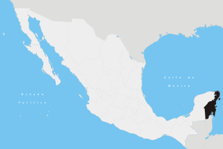
Español: Ubicación del estado de Quintana Roo en la República Mexicana |
||
| Dato | |||
| Kilde | Eget arbejde | ||
| Forfatter | Yavidaxiu | ||
| Tilladelse (Genbrug af denne fil) |
|
Filhistorik
Klik på en dato/tid for at se filen som den så ud på det tidspunkt.
| Dato/tid | Miniaturebillede | Dimensioner | Bruger | Kommentar | |
|---|---|---|---|---|---|
| nuværende | 27. apr. 2007, 19:48 | | 974 × 653 (218 KB) | Yavidaxiu | {{Information |Description={{es|Ubicación del estado de Quintana Roo en la República Mexicana}} |Source= Trabajo propio |Date= 20 de abril de 2007 |Author= Yavidaxiu |Permission= {{PD-self}} |other_versions= }} Category:Maps of Quintana Roo [[Categ |
Filanvendelse
Der er ingen sider der bruger denne fil.
Global filanvendelse
Følgende andre wikier anvender denne fil:
- Anvendelser på af.wikipedia.org
- Anvendelser på br.wikipedia.org
- Anvendelser på cy.wikipedia.org
- Anvendelser på en.wikipedia.org
- Chetumal
- Quintana Roo
- Bacalar
- Isla Mujeres
- Puerto Juárez
- Coba
- Cancún
- Puerto Morelos
- Benito Juárez Municipality, Quintana Roo
- Playa del Carmen
- Solidaridad Municipality
- Felipe Carrillo Puerto, Quintana Roo
- Tulum
- Sian Kaʼan Biosphere Reserve
- Riviera Maya
- Yoʼokop
- Akumal
- Chacchoben
- Costa Maya
- San Miguel de Cozumel
- Banco Chinchorro
- Kohunlich
- Hondo River (Belize)
- Xcalak
- San Gervasio (Maya site)
- Sistema Dos Ojos
- Sistema Nohoch Nah Chich
- Sistema Ox Bel Ha
- Xcaret
- Isla Holbox
- Chetumal Bay
- Xelha
- Isla Contoy
- Calica
- Othón P. Blanco, Quintana Roo
- Puerto Aventuras
- Playacar
- Tulum, Quintana Roo
- Xel-Ha Park
- Mahahual
- Sistema Sac Actun
- Quintana Roo Speleological Survey
- Altamirano, Quintana Roo
- Xpu Há
- Punta Sur
- Template:QuintanaRoo-geo-stub
- Wikipedia:WikiProject Mexico/State templates
Vis flere globale anvendelser af denne fil.