
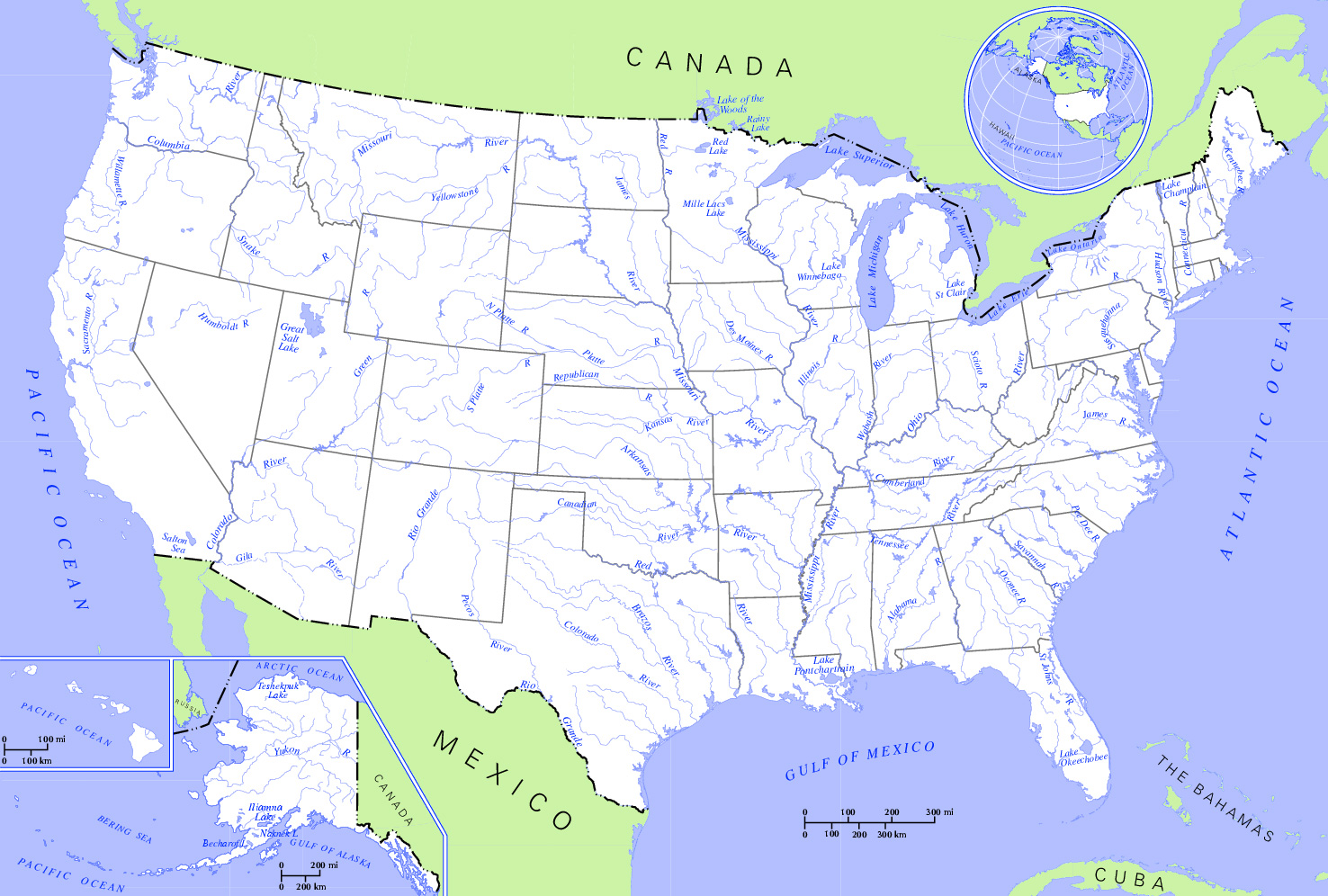
Fil:US map - rivers and lakes2.jpg
Størrelse af denne forhåndsvisning: 800 × 540 pixels. Andre opløsninger: 320 × 216 pixels | 640 × 432 pixels | 1.024 × 691 pixels | 1.476 × 996 pixels.
Fuld opløsning (1.476 × 996 billedpunkter, filstørrelse: 559 KB, MIME-type: image/jpeg)
|
|
Denne fil er fra Wikimedia Commons. Beskrivelsen af filen fra Commons er gengivet nedenfor. |
| Beskrivelse | Rivers and Lakes in the United States. * Author: US Department of Interior * Source: http://nationalatlas.gov, there also available as PDF |
| Dato | (UTC) |
| Kilde | |
| Forfatter | US Department of Interior |
| Dette er et retoucheret billede, hvilket betyder, at det er blevet digitalt ændret fra sin oprindelige version. Ændringer: Changed hue to increase contrast and cropped the map. Originalen kan ses her: US map - rivers and lakes.png. Ændringer blev udført af Monfornot.
|
This map was obtained from an edition of the National Atlas of the United States. Like almost all works of the U.S. federal government, works from the National Atlas are in the public domain in the United States.
Online access: NationalAtlas.gov | 1970 print edition: Library of Congress, Perry-Castañeda Library
|
Oprindelig oplægningslog
This image is a derivative work of the following images:
- File:US_map_-_rivers_and_lakes.png licensed with PD-USGov
- 2004-11-12T15:11:08Z Duesentrieb 1584x1224 (308269 Bytes) Rivers and lakes in the US; Dept. of Interior, Public Domain
Uploaded with derivativeFX
Filhistorik
Klik på en dato/tid for at se filen som den så ud på det tidspunkt.
| Dato/tid | Miniaturebillede | Dimensioner | Bruger | Kommentar | |
|---|---|---|---|---|---|
| nuværende | 2. jan. 2009, 23:12 | | 1.476 × 996 (559 KB) | Monfornot | {{Information |Description=Rivers and Lakes in the United States. * '''Author:''' US Department of Interior * '''Source:''' http://nationalatlas.gov, there also available as PDF |Source=*File:US_map_-_rivers_and_lakes.png |Date=2009-01-02 21:0 |
Filanvendelse
Der er ingen sider der bruger denne fil.
Global filanvendelse
Følgende andre wikier anvender denne fil:
- Anvendelser på az.wikipedia.org
- Anvendelser på be.wikipedia.org
- Anvendelser på bg.wikipedia.org
- Anvendelser på en.wikipedia.org
- Anvendelser på hy.wikipedia.org
- Anvendelser på ru.wikipedia.org