
Fil:Bristol map 1946.jpg
Størrelse af denne forhåndsvisning: 645 × 599 pixels. Andre opløsninger: 258 × 240 pixels | 517 × 480 pixels | 827 × 768 pixels | 1.102 × 1.024 pixels | 2.204 × 2.048 pixels | 4.960 × 4.608 pixels.
Fuld opløsning (4.960 × 4.608 billedpunkter, filstørrelse: 3,75 MB, MIME-type: image/jpeg)
|
|
Denne fil er fra Wikimedia Commons. Beskrivelsen af filen fra Commons er gengivet nedenfor. |
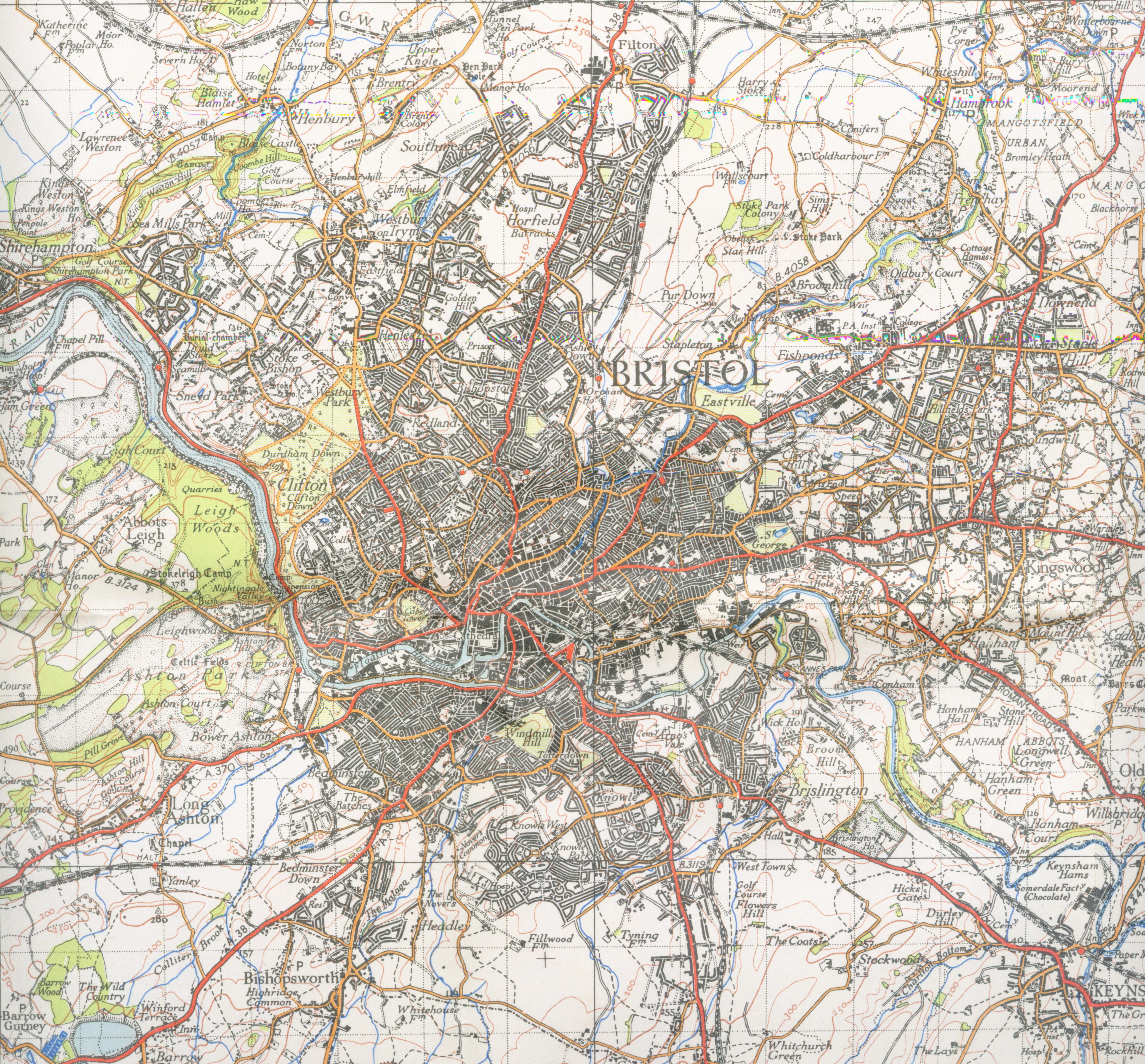
| Beskrivelse | Map of Bristol from 1946. Scale 1 inch to the mile 600DPI Sheet 156 | ||||
| Dato | |||||
| Kilde | OS | ||||
| Forfatter | OS | ||||
| Tilladelse (Genbrug af denne fil) |
|

| Kameraposition | | Dette og andre billeder på deres position på: OpenStreetMap |
|---|
Filhistorik
Klik på en dato/tid for at se filen som den så ud på det tidspunkt.
| Dato/tid | Miniaturebillede | Dimensioner | Bruger | Kommentar | |
|---|---|---|---|---|---|
| nuværende | 2. dec. 2007, 00:10 | | 4.960 × 4.608 (3,75 MB) | Geni | trying again |
| 16. sep. 2007, 19:20 |  | 4.352 × 4.800 (3,39 MB) | Geni | {{Information |Description=Map of Bristol from 1946. Scale 1 inch to the mile 600DPI Sheet 156 |Source=OS |Date=1946 |Author=OS |Permission=none needed |other_versions= }} {{oldOS}} Category:Maps of cities in the United Kingdom Category:Bristol |
Filanvendelse
Der er ingen sider der bruger denne fil.
Global filanvendelse
Følgende andre wikier anvender denne fil:
- Anvendelser på azb.wikipedia.org
- Anvendelser på en.wikipedia.org
- Anvendelser på he.wikipedia.org
- Anvendelser på kn.wikipedia.org